Mpumalanga night lights from space
Night Light of Mpumalanga (KwaZulu-Natal) from space (South Africa) Src. Average luminocity for 10x10km area is 35.0794% and for 50x50km: 18.8326%.
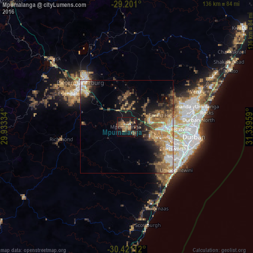
Analysis of Mpumalanga night lights 2016
Square area 10x10 km:
 0.2%
0.2%90-99
2.78%80-89
1.39%70-79
4.17%60-69
13.29%50-59
14.29%40-49
5.16%30-39
5.36%20-29
6.35%10-19
38.1%0-9
8.93%Square area 50x50 km:
1.97%90-99
2.33%80-89
2.31%70-79
3.43%60-69
3.42%50-59
3.93%40-49
3.23%30-39
3.49%20-29
3.93%10-19
10.42%0-9
61.55%Clear (daylight) street map image can be seen on geolist.org.
Map coordinates:
29° 12' 3.6" South, 29° 56' 0" East
29° 48' 46.5" South, 30° 38' 11.3" East
30° 25' 16" South, 31° 20' 22.5" East
Some cities around Mpumalanga sort by population:
• Durban
38.2 km =23.7 mi,  97°
97°
• Pietermaritzburg
32.1 km =19.9 mi,  312°
312°
• Richmond
35.7 km =22.2 mi,  259°
259°
• Howick
54.1 km =33.6 mi, 313°
• Mpophomeni
51.3 km =31.9 mi,  302°
302°
• Scottburgh
53.9 km =33.5 mi,  167°
167°
• eMkhomazi
46.5 km =28.9 mi,  160°
160°
• Berea
34.7 km =21.6 mi, 97°
973111 (p: 140,121)
Sources (retrieved 2019-11-25):
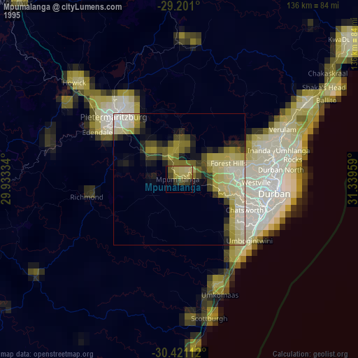
» NASA, Earths city lights 1995
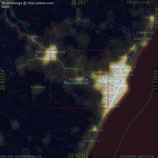
» NASA city lights 2003
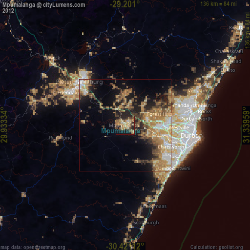
» Earth at Night: Flat Maps 2012, 2016