Howick night lights from space
Night Light of Howick (KwaZulu-Natal) from space (South Africa) Src. Average luminocity for 10x10km area is 14.0833% and for 50x50km: 10.5086%.
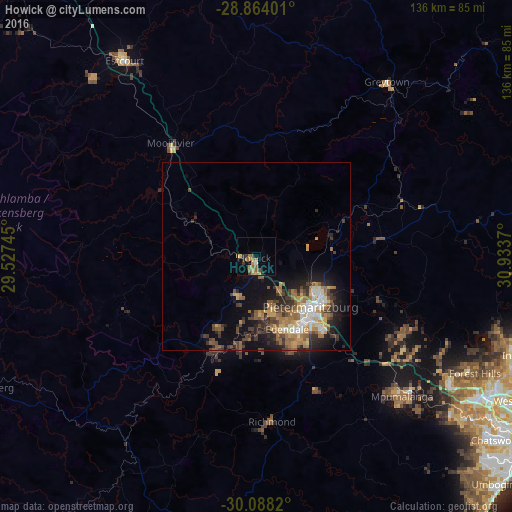
Analysis of Howick night lights 2016
Square area 10x10 km:
 0.76%
0.76%90-99
0%80-89
1.33%70-79
4.17%60-69
2.84%50-59
4.73%40-49
1.33%30-39
3.03%20-29
1.14%10-19
1.14%0-9
79.55%Square area 50x50 km:
1.03%90-99
1.34%80-89
1.14%70-79
1.8%60-69
1.95%50-59
2.06%40-49
1.8%30-39
2.01%20-29
2.37%10-19
5.45%0-9
79.05%Clear (daylight) street map image can be seen on geolist.org.
Map coordinates:
28° 51' 50.4" South, 29° 31' 38.8" East
29° 28' 40.6" South, 30° 13' 50.1" East
30° 5' 17.5" South, 30° 56' 1.3" East
Some cities around Howick sort by population:
• Durban
88 km =54.7 mi,  118°
118°
• Pietermaritzburg
22 km =13.7 mi,  134°
134°
• Mpumalanga
54.1 km =33.6 mi, 133°
• Richmond
44 km =27.3 mi,  174°
174°
• Mpophomeni
10.9 km =6.8 mi,  203°
203°
• Berea
84.6 km =52.6 mi, 119°
• Greytown
57.9 km =36 mi,  37°
37°
• Mooirivier
37.7 km =23.4 mi,  322°
322°
995202 (p: 28,725)
Sources (retrieved 2019-11-25):
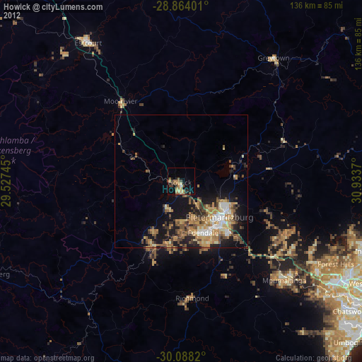
» Earth at Night: Flat Maps 2012, 2016