eSikhaleni night lights from space
Night Light of eSikhaleni (KwaZulu-Natal) from space (South Africa) Src. Average luminocity for 10x10km area is 36.0055% and for 50x50km: 10.9489%.
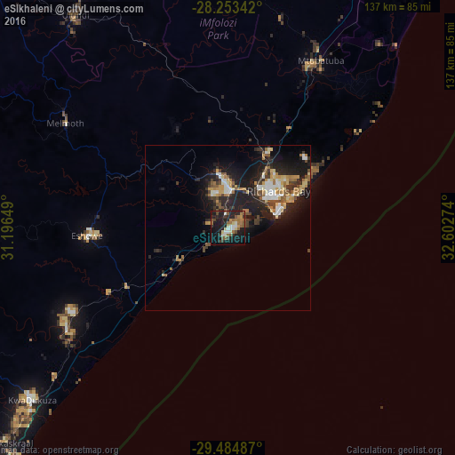
Analysis of eSikhaleni night lights 2016
Square area 10x10 km:
 3.64%
3.64%90-99
5.64%80-89
3.82%70-79
2.36%60-69
8.91%50-59
8%40-49
3.64%30-39
4.36%20-29
14.91%10-19
33.45%0-9
11.27%Square area 50x50 km:
1.2%90-99
1.5%80-89
1.45%70-79
1.36%60-69
1.69%50-59
1.31%40-49
1.32%30-39
2.06%20-29
4.19%10-19
9.67%0-9
74.26%Clear (daylight) street map image can be seen on geolist.org.
Map coordinates:
28° 15' 12.3" South, 31° 11' 47.4" East
28° 52' 15.5" South, 31° 53' 58.6" East
29° 29' 5.5" South, 32° 36' 9.9" East
Some cities around eSikhaleni sort by population:
• Richards Bay
16.6 km =10.3 mi,  53°
53°
• KwaDukuza
78.1 km =48.5 mi,  229°
229°
• Empangeni
12.1 km =7.5 mi,  357°
357°
• Ulundi
76 km =47.2 mi,  321°
321°
• Ballito
99.7 km =62 mi,  221°
221°
• Eshowe
41.9 km =26 mi,  267°
267°
• Greytown
128.9 km =80.1 mi,  260°
260°
• Sundumbili
56.9 km =35.4 mi,  239°
239°
1005029 (p: 49,265)
Sources (retrieved 2019-11-25):
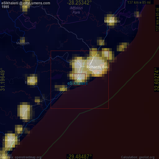
» NASA, Earths city lights 1995
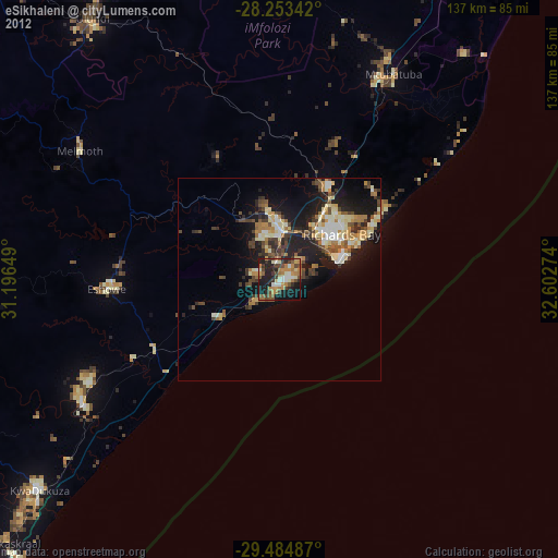
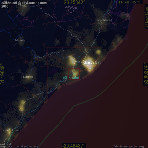
» NASA city lights 2003
» Earth at Night: Flat Maps 2012, 2016