Eshowe night lights from space
Night Light of Eshowe (KwaZulu-Natal) from space (South Africa) Src. Average luminocity for 10x10km area is 17.4836% and for 50x50km: 1.7173%.
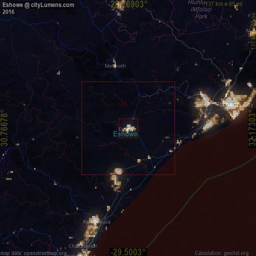
Analysis of Eshowe night lights 2016
Square area 10x10 km:
 2.55%
2.55%90-99
1.82%80-89
2.73%70-79
2.36%60-69
3.27%50-59
1.82%40-49
1.27%30-39
1.09%20-29
3.82%10-19
4.91%0-9
74.36%Square area 50x50 km:
0.14%90-99
0.17%80-89
0.29%70-79
0.27%60-69
0.24%50-59
0.31%40-49
0.14%30-39
0.16%20-29
0.35%10-19
0.73%0-9
97.2%Clear (daylight) street map image can be seen on geolist.org.
Map coordinates:
28° 16' 8.5" South, 30° 46' 0.4" East
28° 53' 11.4" South, 31° 28' 11.6" East
29° 30' 1.1" South, 32° 10' 22.9" East
Some cities around Eshowe sort by population:
• Richards Bay
56.5 km =35.1 mi,  78°
78°
• KwaDukuza
52.1 km =32.4 mi,  199°
199°
• eSikhaleni
41.9 km =26 mi,  87°
87°
• Empangeni
43.5 km =27 mi,  71°
71°
• Ulundi
61.5 km =38.2 mi,  355°
355°
• Ballito
76.7 km =47.7 mi, 198°
• Greytown
87.6 km =54.4 mi,  256°
256°
• Sundumbili
28.4 km =17.6 mi,  194°
194°
1005040 (p: 14,786)
Sources (retrieved 2019-11-25):
» Earth at Night: Flat Maps 2012, 2016