Sundumbili night lights from space
Night Light of Sundumbili (KwaZulu-Natal) from space (South Africa) Src. Average luminocity for 10x10km area is 31.7163% and for 50x50km: 3.1486%.
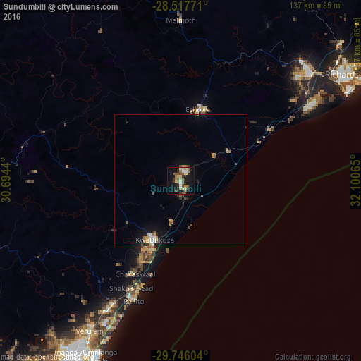
Analysis of Sundumbili night lights 2016
Square area 10x10 km:
 1.39%
1.39%90-99
4.37%80-89
8.33%70-79
2.78%60-69
2.98%50-59
8.53%40-49
4.17%30-39
4.17%20-29
5.75%10-19
32.14%0-9
25.4%Square area 50x50 km:
0.2%90-99
0.35%80-89
0.48%70-79
0.47%60-69
0.39%50-59
0.57%40-49
0.3%30-39
0.44%20-29
0.5%10-19
2.78%0-9
93.51%Clear (daylight) street map image can be seen on geolist.org.
Map coordinates:
28° 31' 3.8" South, 30° 41' 39.8" East
29° 8' 1.4" South, 31° 23' 51.1" East
29° 44' 45.7" South, 32° 6' 2.3" East
Some cities around Sundumbili sort by population:
• Durban
88.1 km =54.7 mi,  203°
203°
• Richards Bay
73.5 km =45.7 mi,  57°
57°
• KwaDukuza
24 km =14.9 mi,  205°
205°
• eSikhaleni
56.9 km =35.4 mi, 59°
• Empangeni
63.5 km =39.5 mi,  49°
49°
• Ballito
48.4 km =30.1 mi, 201°
• Eshowe
28.4 km =17.6 mi,  14°
14°
• Greytown
78.6 km =48.8 mi,  275°
275°
951441 (p: 12,455)
Sources (retrieved 2019-11-25):
» Earth at Night: Flat Maps 2012, 2016