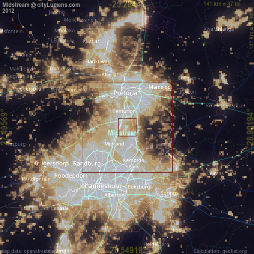
Midstream night lights from space
Night Light of Midstream (Gauteng) from space (South Africa) Src. Average luminocity for 10x10km area is 84.6288% and for 50x50km: 72.4748%.
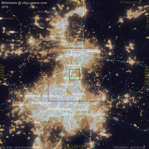
Analysis of Midstream night lights 2016
Square area 10x10 km:
 17.99%
90-99
17.42%80-89
27.27%70-79
27.84%60-69
8.9%50-59
0.57%40-49
0%30-39
0%20-29
0%10-19
0%0-9
0%Square area 50x50 km:
20.3%90-99
18.63%80-89
12.58%70-79
12.91%60-69
7.59%50-59
4.59%40-49
5.91%30-39
4.86%20-29
4.81%10-19
6.59%0-9
1.23%Clear (daylight) street map image can be seen on geolist.org.
Map coordinates:
25° 17' 3.8" South, 27° 29' 44.5" East
25° 55' 6.6" South, 28° 11' 55.7" East
26° 32' 57.1" South, 28° 54' 7" East
Some cities around Midstream sort by population:
• Pretoria
19.3 km =12 mi,  356°
356°
• Tembisa
9.1 km =5.7 mi,  162°
162°
• Diepsloot
18.7 km =11.6 mi,  265°
265°
• Centurion
6.8 km =4.2 mi,  348°
348°
• Midrand
10.6 km =6.6 mi,  221°
221°
• Eden Glen
24 km =14.9 mi,  187°
187°
• Eastleigh
23.9 km =14.9 mi, 190°
• Eden Glen Ext 60
23.3 km =14.5 mi, 188°
8030233 (p: 25,000)
Sources (retrieved 2019-11-25):
» Earth at Night: Flat Maps 2012, 2016