Sayyān night lights from space
Night Light of Sayyān (Sanaa) from space (Yemen) Src. Average luminocity for 10x10km area is 0% and for 50x50km: 2.0456%.
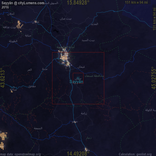
Analysis of Sayyān night lights 2016
Square area 10x10 km:
 0%
0%90-99
0%80-89
0%70-79
0%60-69
0%50-59
0%40-49
0%30-39
0%20-29
0%10-19
0%0-9
100%Square area 50x50 km:
0.02%90-99
0.01%80-89
0.07%70-79
0%60-69
1.29%50-59
0.47%40-49
0.31%30-39
0.42%20-29
0.46%10-19
1.99%0-9
94.96%Clear (daylight) street map image can be seen on geolist.org.
Map coordinates:
15° 50' 57.4" North, 43° 37' 16.7" East
15° 10' 18.4" North, 44° 19' 27.9" East
14° 29' 31.5" North, 45° 1' 39.2" East
Some cities around Sayyān sort by population:
• Sanaa
23.9 km =14.9 mi,  328°
328°
• Dhamār
70.5 km =43.8 mi,  172°
172°
• ‘Amrān
67.9 km =42.2 mi,  323°
323°
• Ḩajjah
96.5 km =60 mi,  307°
307°
• Saḩar
16.2 km =10.1 mi,  354°
354°
• Al Maḩwīt
89.9 km =55.9 mi,  291°
291°
• Jadder Cemetery
36.4 km =22.6 mi, 334°
• Al Jabīn
93.7 km =58.2 mi,  236°
236°
70979 (p: 69,404)
Sources (retrieved 2019-11-25):
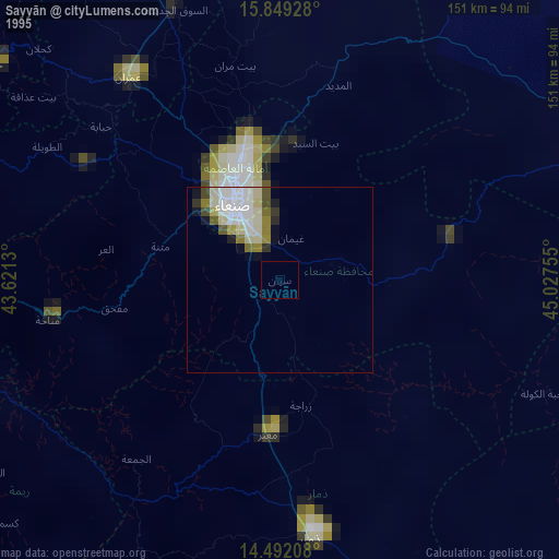
» NASA, Earths city lights 1995
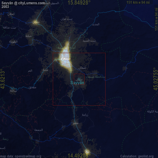
» NASA city lights 2003
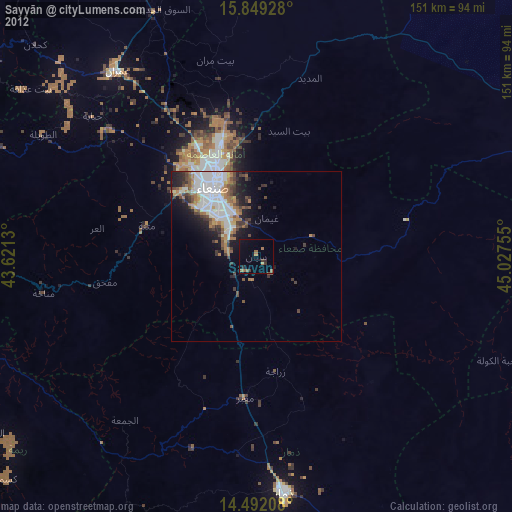
» Earth at Night: Flat Maps 2012, 2016