Sanaa night lights from space
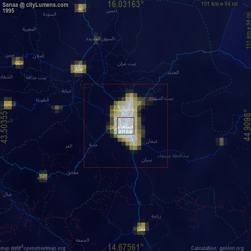
Night Light of Sanaa from space (Yemen) Src. Average luminocity for 10x10km area is 36.2965% and for 50x50km: 2.5172%.
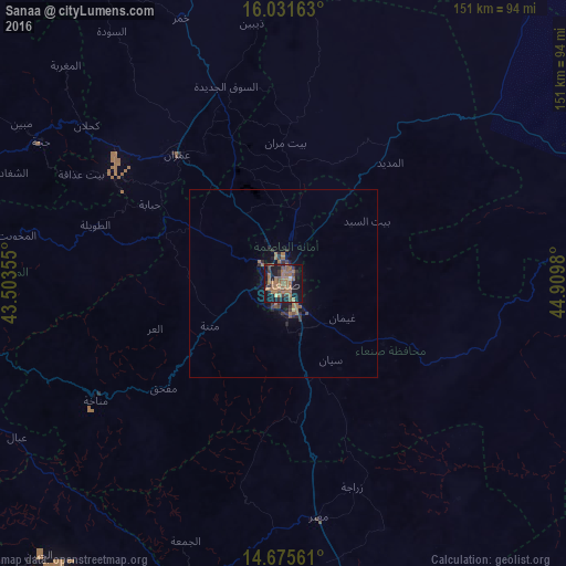
Analysis of Sanaa night lights 2016
Square area 10x10 km:
 0.65%
0.65%90-99
0.22%80-89
0.87%70-79
0%60-69
27.71%50-59
10.82%40-49
4.76%30-39
6.49%20-29
6.49%10-19
36.36%0-9
5.63%Square area 50x50 km:
0.03%90-99
0.01%80-89
0.07%70-79
0%60-69
1.54%50-59
0.55%40-49
0.33%30-39
0.56%20-29
0.77%10-19
2.28%0-9
93.88%Clear (daylight) street map image can be seen on geolist.org.
Map coordinates:
16° 1' 53.9" North, 43° 30' 12.8" East
15° 21' 17" North, 44° 12' 24" East
14° 40' 32.2" North, 44° 54' 35.3" East
Some cities around Sanaa sort by population:
• Dhamār
92.8 km =57.7 mi,  166°
166°
• ‘Amrān
44.1 km =27.4 mi,  320°
320°
• Sayyān
23.9 km =14.9 mi,  148°
148°
• Ḩajjah
74.6 km =46.4 mi,  300°
300°
• Saḩar
11.8 km =7.3 mi,  111°
111°
• Al Maḩwīt
72.1 km =44.8 mi,  280°
280°
• Jadder Cemetery
12.9 km =8 mi,  346°
346°
• Al Jabīn
97.4 km =60.5 mi,  222°
222°
71137 (p: 1,937,451)
Sources (retrieved 2019-11-25):
» NASA, Earths city lights 1995
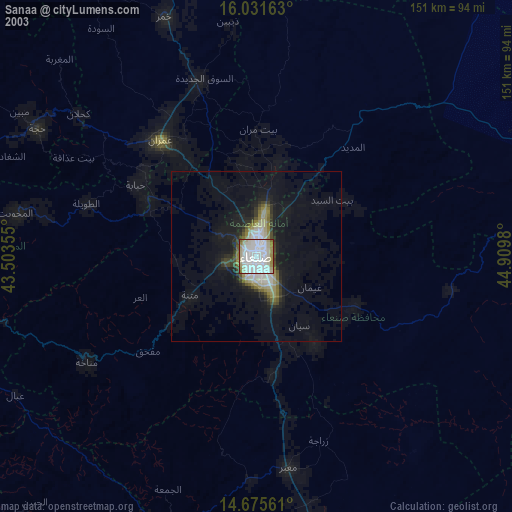
» NASA city lights 2003
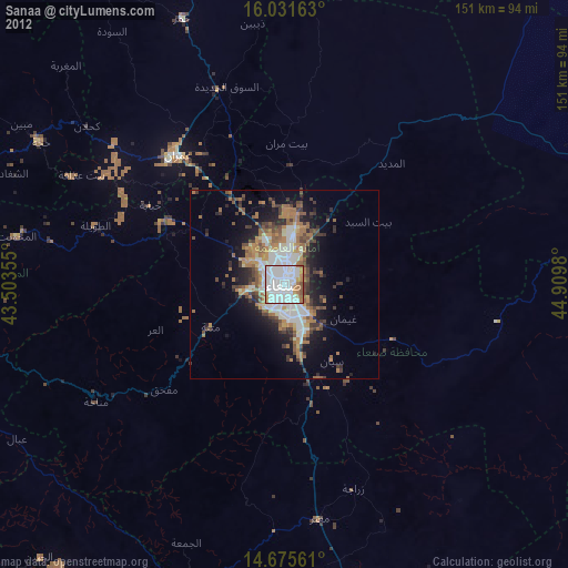
» Earth at Night: Flat Maps 2012, 2016