Ma'rib night lights from space
Night Light of Ma'rib (Ma’rib) from space (Yemen) Src. Average luminocity for 10x10km area is 33.6948% and for 50x50km: 2.6564%.
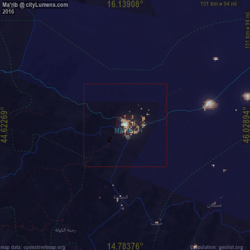
Analysis of Ma'rib night lights 2016
Square area 10x10 km:
 3.9%
3.9%90-99
1.52%80-89
1.3%70-79
3.68%60-69
16.02%50-59
5.63%40-49
3.46%30-39
4.11%20-29
11.9%10-19
29.65%0-9
18.83%Square area 50x50 km:
0.15%90-99
0.06%80-89
0.05%70-79
0.18%60-69
1.15%50-59
0.62%40-49
0.23%30-39
0.55%20-29
0.93%10-19
2.45%0-9
93.63%Clear (daylight) street map image can be seen on geolist.org.
Map coordinates:
16° 8' 20.7" North, 44° 37' 21.7" East
15° 27' 45.1" North, 45° 19' 32.9" East
14° 47' 1.5" North, 46° 1' 44.2" East
Some cities around Ma'rib sort by population:
• Sanaa
120.6 km =74.9 mi,  264°
264°
• Dhamār
142.3 km =88.4 mi,  224°
224°
• ‘Amrān
149.6 km =93 mi,  278°
278°
• Sayyān
112.1 km =69.7 mi,  253°
253°
• Yarīm
164.7 km =102.3 mi, 218°
• Saḩar
110.2 km =68.5 mi, 261°
• Al Ḩazm
97.6 km =60.6 mi,  323°
323°
• Jadder Cemetery
123 km =76.4 mi,  270°
270°
72968 (p: 16,794)
Sources (retrieved 2019-11-25):
» Earth at Night: Flat Maps 2012, 2016