Ibb night lights from space
Night Light of Ibb from space (Yemen) Src. Average luminocity for 10x10km area is 3.3678% and for 50x50km: 0.2016%.
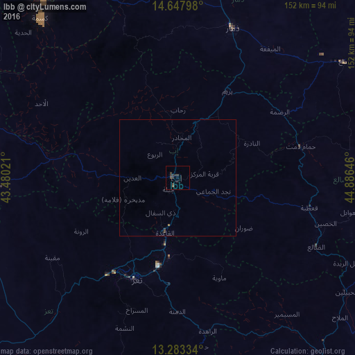
Analysis of Ibb night lights 2016
Square area 10x10 km:
 0%
0%90-99
0%80-89
0%70-79
0%60-69
0.83%50-59
0%40-49
1.65%30-39
3.72%20-29
1.24%10-19
0.83%0-9
91.74%Square area 50x50 km:
0%90-99
0%80-89
0%70-79
0%60-69
0.07%50-59
0%40-49
0.1%30-39
0.18%20-29
0.05%10-19
0.07%0-9
99.54%Clear (daylight) street map image can be seen on geolist.org.
Map coordinates:
14° 38' 52.7" North, 43° 28' 48.8" East
13° 58' 0" North, 44° 10' 60" East
13° 17' 0" North, 44° 53' 11.3" East
Some cities around Ibb sort by population:
• Ta‘izz
46.5 km =28.9 mi,  202°
202°
• Dhamār
68.4 km =42.5 mi,  20°
20°
• Zabīd
97 km =60.3 mi,  285°
285°
• Dhī as Sufāl
16.5 km =10.3 mi,  206°
206°
• Bayt al Faqīh
110.9 km =68.9 mi,  303°
303°
• Yarīm
42.4 km =26.3 mi,  29°
29°
• Dhalie
66.4 km =41.3 mi,  116°
116°
• Al Jabīn
103.3 km =64.2 mi,  322°
322°
74477 (p: 234,837)
Sources (retrieved 2019-11-25):
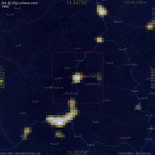
» NASA, Earths city lights 1995
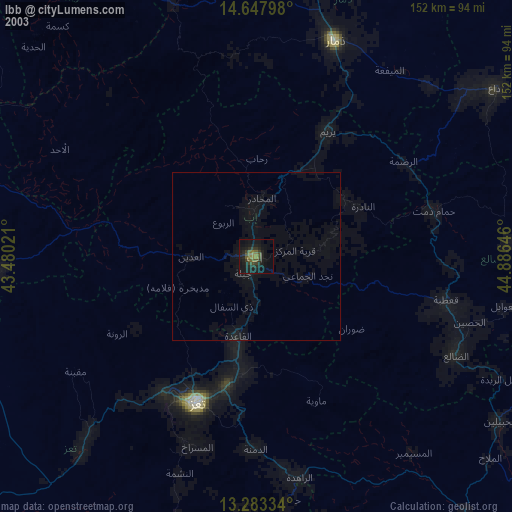
» NASA city lights 2003
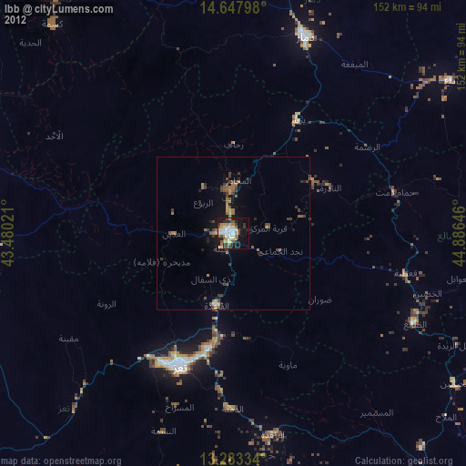
» Earth at Night: Flat Maps 2012, 2016