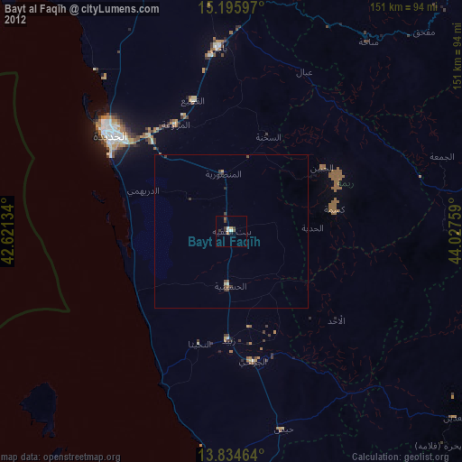
Bayt al Faqīh night lights from space
Night Light of Bayt al Faqīh (Al Hudaydah) from space (Yemen) Src. Average luminocity for 10x10km area is 2.7965% and for 50x50km: 0.1902%.
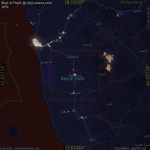
Analysis of Bayt al Faqīh night lights 2016
Square area 10x10 km:
 0%
0%90-99
0%80-89
0.87%70-79
0%60-69
0.87%50-59
0.87%40-49
0.87%30-39
0.65%20-29
0.87%10-19
0.22%0-9
94.81%Square area 50x50 km:
0%90-99
0%80-89
0.03%70-79
0%60-69
0.03%50-59
0.13%40-49
0.07%30-39
0.02%20-29
0.03%10-19
0.07%0-9
99.61%Clear (daylight) street map image can be seen on geolist.org.
Map coordinates:
15° 11' 45.5" North, 42° 37' 16.8" East
14° 30' 58.9" North, 43° 19' 28.1" East
13° 50' 4.7" North, 44° 1' 39.3" East
Some cities around Bayt al Faqīh sort by population:
• Al Ḩudaydah
50.6 km =31.4 mi,  308°
308°
• Ibb
110.9 km =68.9 mi,  123°
123°
• Zabīd
35.7 km =22.2 mi,  181°
181°
• Bājil
60.5 km =37.6 mi,  356°
356°
• Dhī as Sufāl
114 km =70.8 mi,  131°
131°
• Yarīm
116 km =72.1 mi,  102°
102°
• Al Maḩwīt
108.7 km =67.5 mi,  12°
12°
• Al Jabīn
36.2 km =22.5 mi,  54°
54°
76991 (p: 34,204)
Sources (retrieved 2019-11-25):
» Earth at Night: Flat Maps 2012, 2016