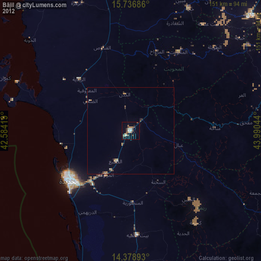
Bājil night lights from space
Night Light of Bājil (Al Hudaydah) from space (Yemen) Src. Average luminocity for 10x10km area is 3.2004% and for 50x50km: 0.4453%.
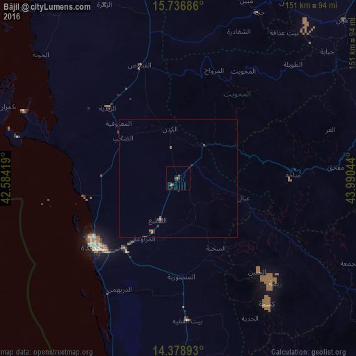
Analysis of Bājil night lights 2016
Square area 10x10 km:
 0%
0%90-99
0%80-89
0%70-79
0%60-69
1.65%50-59
0.83%40-49
0.21%30-39
2.48%20-29
1.45%10-19
0.41%0-9
92.98%Square area 50x50 km:
0.02%90-99
0.02%80-89
0%70-79
0.06%60-69
0.17%50-59
0.08%40-49
0.03%30-39
0.27%20-29
0.18%10-19
0.07%0-9
99.11%Clear (daylight) street map image can be seen on geolist.org.
Map coordinates:
15° 44' 12.7" North, 42° 35' 3.1" East
15° 3' 32.3" North, 43° 17' 14.3" East
14° 22' 44.1" North, 43° 59' 25.6" East
Some cities around Bājil sort by population:
• Sanaa
104 km =64.6 mi,  71°
71°
• Al Ḩudaydah
46.1 km =28.6 mi,  230°
230°
• ‘Amrān
97 km =60.3 mi,  46°
46°
• Zabīd
96.1 km =59.7 mi,  178°
178°
• Ḩajjah
78.5 km =48.8 mi,  25°
25°
• Bayt al Faqīh
60.5 km =37.6 mi, 176°
• Al Maḩwīt
53.4 km =33.2 mi, 31°
• Al Jabīn
51.8 km =32.2 mi,  139°
139°
77408 (p: 48,218)
Sources (retrieved 2019-11-25):
» Earth at Night: Flat Maps 2012, 2016