Al Ḩudaydah night lights from space
Night Light of Al Ḩudaydah (Al Hudaydah) from space (Yemen) Src. Average luminocity for 10x10km area is 43.7624% and for 50x50km: 3.0551%.
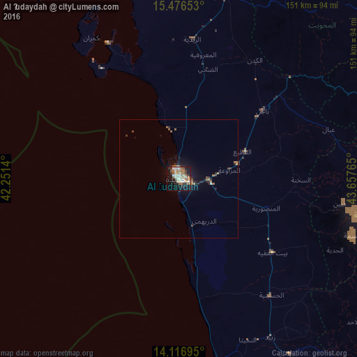
Analysis of Al Ḩudaydah night lights 2016
Square area 10x10 km:
 3.72%
3.72%90-99
10.74%80-89
9.09%70-79
1.65%60-69
15.29%50-59
3.31%40-49
1.24%30-39
5.99%20-29
6.82%10-19
33.68%0-9
8.47%Square area 50x50 km:
0.18%90-99
0.46%80-89
0.36%70-79
0.21%60-69
1.03%50-59
0.24%40-49
0.21%30-39
0.48%20-29
0.78%10-19
2.73%0-9
93.32%Clear (daylight) street map image can be seen on geolist.org.
Map coordinates:
15° 28' 35.5" North, 42° 15' 5" East
14° 47' 52.1" North, 42° 57' 16.3" East
14° 7' 1" North, 43° 39' 27.5" East
Some cities around Al Ḩudaydah sort by population:
• Sanaa
148 km =92 mi,  65°
65°
• ‘Amrān
143 km =88.9 mi,  47°
47°
• Zabīd
77.4 km =48.1 mi,  149°
149°
• Bājil
46.1 km =28.6 mi, 50°
• Ḩajjah
121.7 km =75.6 mi,  35°
35°
• Bayt al Faqīh
50.6 km =31.4 mi,  128°
128°
• Al Maḩwīt
98 km =60.9 mi, 40°
• Al Jabīn
70.1 km =43.6 mi,  98°
98°
79415 (p: 617,871)
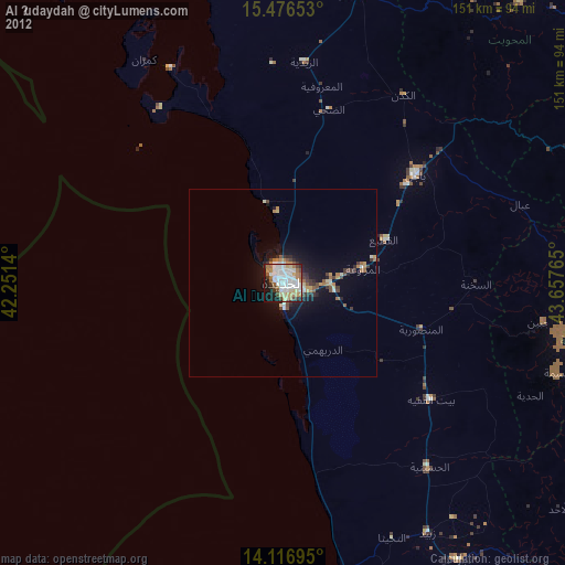
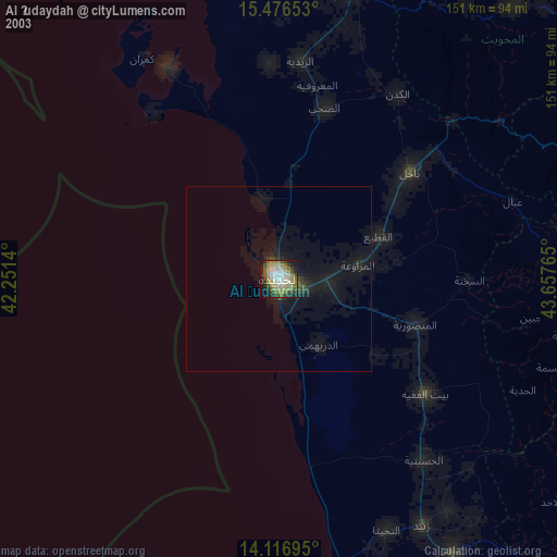
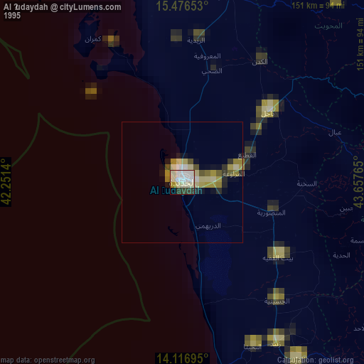
Sources (retrieved 2019-11-25):
» NASA, Earths city lights 1995
» NASA city lights 2003
» Earth at Night: Flat Maps 2012, 2016