Sa Pa night lights from space
Night Light of Sa Pa (Lào Cai) from space (Vietnam) Src. Average luminocity for 10x10km area is 5.4148% and for 50x50km: 1.9863%.
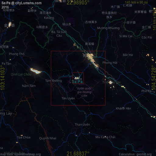
Analysis of Sa Pa night lights 2016
Square area 10x10 km:
 0.76%
0.76%90-99
0.76%80-89
0%70-79
0.76%60-69
0.76%50-59
1.52%40-49
0.76%30-39
1.14%20-29
1.89%10-19
0%0-9
91.67%Square area 50x50 km:
0.03%90-99
0.03%80-89
0.19%70-79
0.34%60-69
0.77%50-59
0.25%40-49
0.29%30-39
0.36%20-29
0.49%10-19
1.39%0-9
95.86%Clear (daylight) street map image can be seen on geolist.org.
Map coordinates:
22° 59' 20.6" North, 103° 8' 27.7" East
22° 20' 24.8" North, 103° 50' 38.9" East
21° 41' 18.1" North, 104° 32' 50.2" East
Some cities around Sa Pa sort by population:
• Wenshan City, CN
121.1 km =75.2 mi,  20°
20°
• Yên Bái
129.7 km =80.6 mi,  121°
121°
• Kaihua, CN
122.7 km =76.2 mi, 21°
• Mabai, CN
97.3 km =60.5 mi,  39°
39°
• Lào Cai
20.7 km =12.9 mi, 38°
• Hà Giang
128.7 km =80 mi,  65°
65°
• Sơn La
113.1 km =70.3 mi,  176°
176°
• Lai Châu
40.2 km =25 mi,  278°
278°
1568043 (p: 10,554)
Sources (retrieved 2019-11-25):
» Earth at Night: Flat Maps 2012, 2016