Kaihua night lights from space
Night Light of Kaihua (Yunnan) from space (China) Src. Average luminocity for 10x10km area is 48.0814% and for 50x50km: 4.2831%.

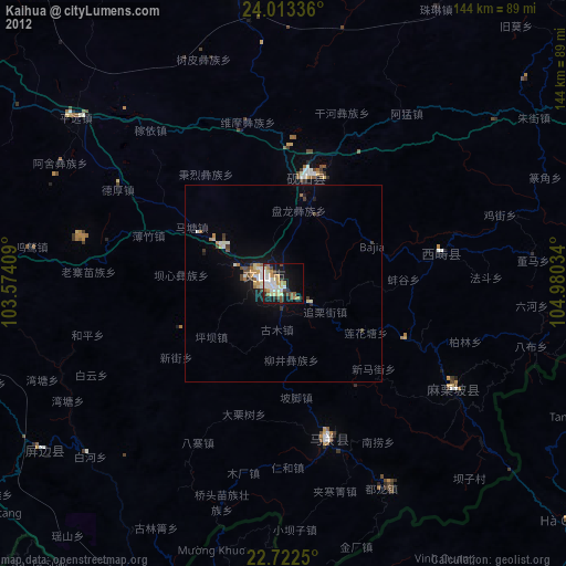


Analysis of Kaihua night lights 2016
Square area 10x10 km:
 11.36%
90-99
9.47%80-89
3.6%70-79
5.3%60-69
9.09%50-59
6.82%40-49
6.63%30-39
4.55%20-29
13.26%10-19
17.8%0-9
12.12%Square area 50x50 km:
0.65%90-99
0.59%80-89
0.23%70-79
0.55%60-69
0.53%50-59
0.58%40-49
0.67%30-39
0.66%20-29
1.17%10-19
3.64%0-9
90.73%Clear (daylight) street map image can be seen on geolist.org.
Map coordinates:
24° 0' 48.1" North, 103° 34' 26.7" East
23° 22' 10.2" North, 104° 16' 38" East
22° 43' 21" North, 104° 58' 49.2" East
Some cities around Kaihua sort by population:
• Wenshan City
2.8 km =1.7 mi,  255°
255°
• Kaiyuan
105.7 km =65.7 mi,  290°
290°
• Gejiu
114.7 km =71.3 mi,  269°
269°
• Mabai
43.5 km =27 mi,  155°
155°
• Lào Cai, VN
103.2 km =64.1 mi,  197°
197°
• Hà Giang, VN
94.4 km =58.7 mi,  130°
130°
• Sa Pa, VN
122.7 km =76.2 mi, 201°
• Lai Châu, VN
136.9 km =85.1 mi,  217°
217°
1804874 (p: 64,404)
Sources (retrieved 2019-11-25):
» NASA, Earths city lights 1995
» NASA city lights 2003
» Earth at Night: Flat Maps 2012, 2016