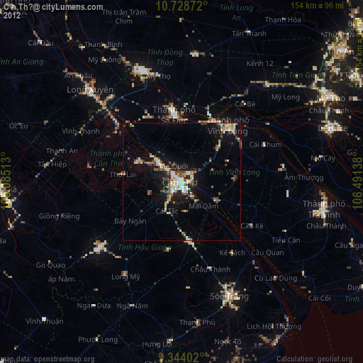
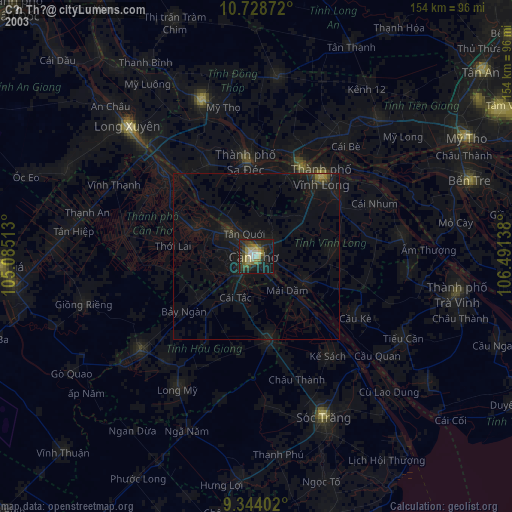
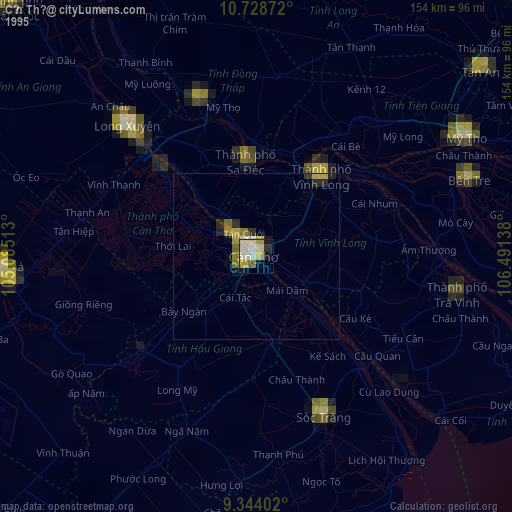
Cần Thơ night lights from space
Night Light of Cần Thơ (Can Tho) from space (Vietnam) Src. Average luminocity for 10x10km area is 73.2479% and for 50x50km: 13.2535%.
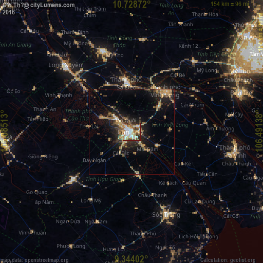
Analysis of Cần Thơ night lights 2016
Square area 10x10 km:
 16.94%
90-99
19.63%80-89
9.5%70-79
12.4%60-69
13.43%50-59
7.23%40-49
7.85%30-39
7.02%20-29
5.79%10-19
0.21%0-9
0%Square area 50x50 km:
0.88%90-99
1.25%80-89
2%70-79
2.35%60-69
2.36%50-59
1.46%40-49
2.21%30-39
2.47%20-29
4.06%10-19
9.34%0-9
71.62%Clear (daylight) street map image can be seen on geolist.org.
Map coordinates:
10° 43' 43.4" North, 105° 5' 6.5" East
10° 2' 13.6" North, 105° 47' 17.7" East
9° 20' 38.5" North, 106° 29' 29" East
Some cities around Cần Thơ sort by population:
• Sa Dec
28.4 km =17.6 mi,  352°
352°
• Long Xuyên
54.8 km =34.1 mi,  315°
315°
• Sóc Trăng
52.6 km =32.7 mi,  157°
157°
• Vĩnh Long
31.4 km =19.5 mi,  39°
39°
• Cao Lãnh
50 km =31.1 mi,  340°
340°
• Vị Thanh
44.8 km =27.8 mi,  231°
231°
• Thị Trấn Tân Thành
32.4 km =20.1 mi, 318°
• Ấp Tân Ngãi
58.4 km =36.3 mi,  68°
68°
1586203 (p: 259,598)
Sources (retrieved 2019-11-25):
» NASA, Earths city lights 1995
» NASA city lights 2003
» Earth at Night: Flat Maps 2012, 2016