San Cristóbal night lights from space
Night Light of San Cristóbal (Táchira) from space (Venezuela) Src. Average luminocity for 10x10km area is 60.8905% and for 50x50km: 10.156%.
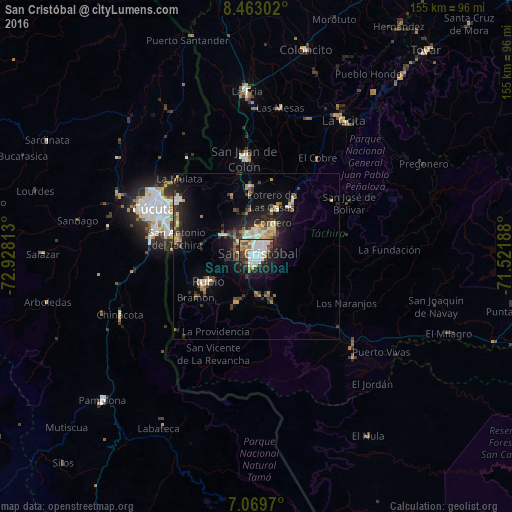

Analysis of San Cristóbal night lights 2016
Square area 10x10 km:
 16.53%
90-99
20.87%80-89
1.65%70-79
8.06%60-69
7.02%50-59
3.31%40-49
6.2%30-39
5.99%20-29
13.43%10-19
15.7%0-9
1.24%Square area 50x50 km:
1.14%90-99
1.9%80-89
0.77%70-79
1.43%60-69
1.25%50-59
0.81%40-49
1.19%30-39
2.63%20-29
3.02%10-19
6.86%0-9
79.01%Clear (daylight) street map image can be seen on geolist.org.
Map coordinates:
8° 27' 46.9" North, 72° 55' 41.3" West
7° 46' 1" North, 72° 13' 30" West
7° 4' 10.9" North, 71° 31' 18.8" West
Some cities around San Cristóbal sort by population:
• Cúcuta, CO
34.2 km =21.3 mi,  294°
294°
• Villa del Rosario, CO
28.4 km =17.6 mi, 285°
• Los Patios, CO
31.7 km =19.7 mi,  284°
284°
• Rubio
16.1 km =10 mi,  243°
243°
• Colón
29.6 km =18.4 mi,  352°
352°
• San Antonio del Táchira
24.6 km =15.3 mi, 282°
• Táriba
5.8 km =3.6 mi,  0°
0°
• Chinácota, CO
45.1 km =28 mi,  246°
246°
3628473 (p: 246,583)
Sources (retrieved 2019-11-25):
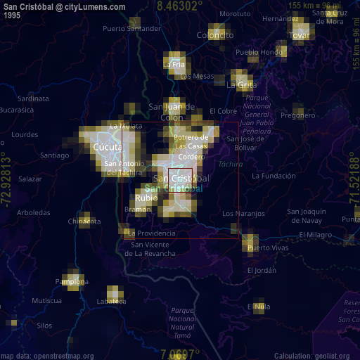
» NASA, Earths city lights 1995
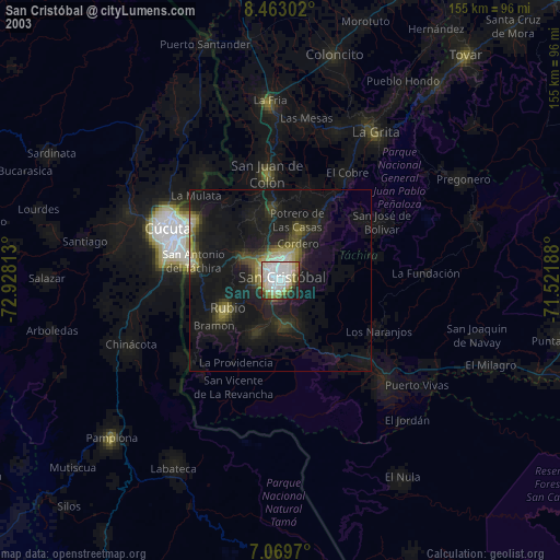
» NASA city lights 2003
» Earth at Night: Flat Maps 2012, 2016