Colón night lights from space
Night Light of Colón (Táchira) from space (Venezuela) Src. Average luminocity for 10x10km area is 12.595% and for 50x50km: 9.4732%.
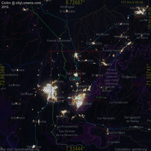
Analysis of Colón night lights 2016
Square area 10x10 km:
 1.24%
1.24%90-99
2.07%80-89
2.48%70-79
2.48%60-69
0.83%50-59
0%40-49
0.83%30-39
2.69%20-29
0.62%10-19
2.27%0-9
84.5%Square area 50x50 km:
1.4%90-99
1.84%80-89
0.89%70-79
1.21%60-69
1.41%50-59
0.58%40-49
0.82%30-39
2.42%20-29
2.32%10-19
4.98%0-9
82.12%Clear (daylight) street map image can be seen on geolist.org.
Map coordinates:
8° 43' 36.7" North, 72° 57' 49.2" West
8° 1' 52.5" North, 72° 15' 37.9" West
7° 20' 4" North, 71° 33' 26.7" West
Some cities around Colón sort by population:
• Cúcuta, CO
31.2 km =19.4 mi,  240°
240°
• San Cristóbal
29.6 km =18.4 mi,  172°
172°
• Villa del Rosario, CO
32.2 km =20 mi,  226°
226°
• Los Patios, CO
34.3 km =21.3 mi, 231°
• Rubio
38.2 km =23.7 mi,  195°
195°
• San Antonio del Táchira
31.4 km =19.5 mi,  219°
219°
• Táriba
24 km =14.9 mi, 170°
• La Fría
20.5 km =12.7 mi,  3°
3°
3628060 (p: 38,233)
Sources (retrieved 2019-11-25):
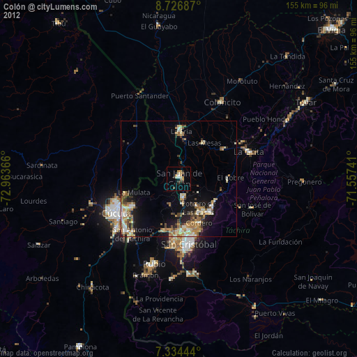
» Earth at Night: Flat Maps 2012, 2016