Rubio night lights from space
Night Light of Rubio (Táchira) from space (Venezuela) Src. Average luminocity for 10x10km area is 17.2913% and for 50x50km: 14.2467%.
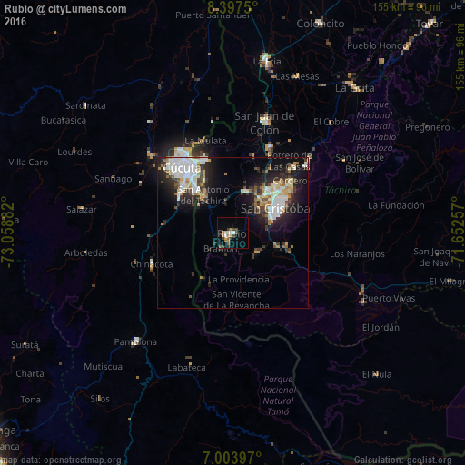
Analysis of Rubio night lights 2016
Square area 10x10 km:
 1.65%
1.65%90-99
1.65%80-89
1.65%70-79
3.51%60-69
2.89%50-59
2.07%40-49
4.55%30-39
2.69%20-29
0.83%10-19
2.27%0-9
76.24%Square area 50x50 km:
2.95%90-99
3.24%80-89
1.11%70-79
1.52%60-69
1.57%50-59
0.94%40-49
1.31%30-39
2.75%20-29
4.02%10-19
7.91%0-9
72.67%Clear (daylight) street map image can be seen on geolist.org.
Map coordinates:
8° 23' 51" North, 73° 3' 31.8" West
7° 42' 4.7" North, 72° 21' 20.5" West
7° 0' 14.3" North, 71° 39' 9.3" West
Some cities around Rubio sort by population:
• Cúcuta, CO
27.2 km =16.9 mi,  321°
321°
• San Cristóbal
16.1 km =10 mi,  63°
63°
• Villa del Rosario, CO
19.7 km =12.2 mi, 318°
• Los Patios, CO
22.3 km =13.9 mi,  312°
312°
• San Antonio del Táchira
15.9 km =9.9 mi, 322°
• Táriba
19.5 km =12.1 mi,  47°
47°
• El Zulia, CO
37.3 km =23.2 mi, 313°
• Chinácota, CO
29 km =18 mi,  248°
248°
3628952 (p: 51,568)
Sources (retrieved 2019-11-25):
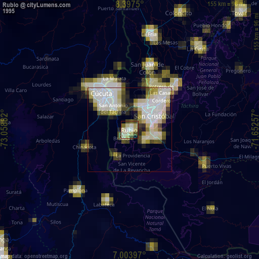
» NASA, Earths city lights 1995
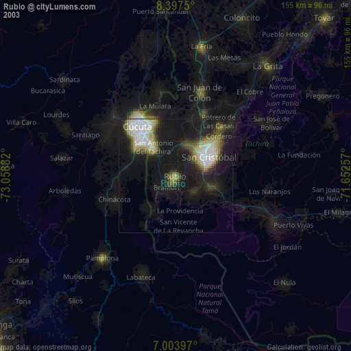
» NASA city lights 2003
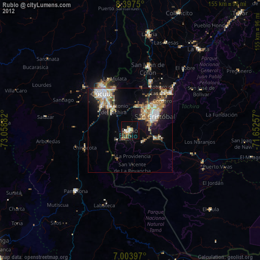
» Earth at Night: Flat Maps 2012, 2016