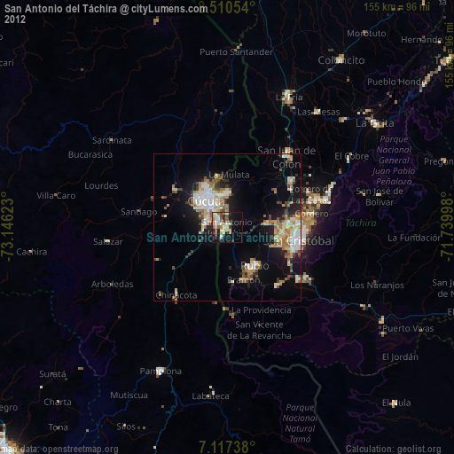
San Antonio del Táchira night lights from space
Night Light of San Antonio del Táchira (Táchira) from space (Venezuela) Src. Average luminocity for 10x10km area is 34.3326% and for 50x50km: 14.489%.
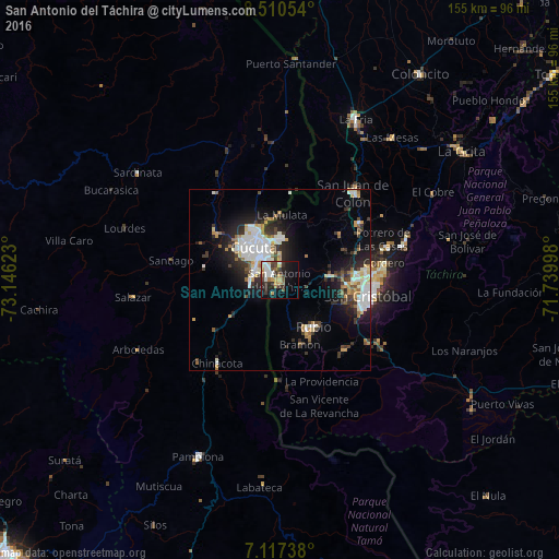
Analysis of San Antonio del Táchira night lights 2016
Square area 10x10 km:
 6.82%
6.82%90-99
4.75%80-89
2.89%70-79
6.2%60-69
3.51%50-59
2.48%40-49
4.34%30-39
10.54%20-29
8.06%10-19
22.93%0-9
27.48%Square area 50x50 km:
3.02%90-99
3.06%80-89
1.09%70-79
1.6%60-69
1.64%50-59
0.93%40-49
1.3%30-39
2.98%20-29
3.88%10-19
7.61%0-9
72.88%Clear (daylight) street map image can be seen on geolist.org.
Map coordinates:
8° 30' 37.9" North, 73° 8' 46.4" West
7° 48' 52.3" North, 72° 26' 35.2" West
7° 7' 2.6" North, 71° 44' 23.9" West
Some cities around San Antonio del Táchira sort by population:
• Cúcuta, CO
11.3 km =7 mi,  321°
321°
• San Cristóbal
24.6 km =15.3 mi,  102°
102°
• Villa del Rosario, CO
4 km =2.5 mi,  302°
302°
• Los Patios, CO
7.2 km =4.5 mi,  291°
291°
• Rubio
15.9 km =9.9 mi,  142°
142°
• Táriba
24.1 km =15 mi,  88°
88°
• El Zulia, CO
21.8 km =13.5 mi,  306°
306°
• Chinácota, CO
28.9 km =18 mi,  217°
217°
3628549 (p: 32,458)
Sources (retrieved 2019-11-25):
» Earth at Night: Flat Maps 2012, 2016