Cúcuta night lights from space
Night Light of Cúcuta (Norte de Santander) from space (Colombia) Src. Average luminocity for 10x10km area is 85.4545% and for 50x50km: 10.1279%.
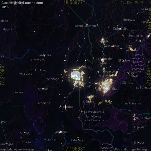

Analysis of Cúcuta night lights 2016
Square area 10x10 km:
 39.46%
90-99
30.99%80-89
5.17%70-79
2.07%60-69
5.79%50-59
2.89%40-49
1.24%30-39
7.85%20-29
4.55%10-19
0%0-9
0%Square area 50x50 km:
2.3%90-99
2.03%80-89
0.75%70-79
0.93%60-69
1.07%50-59
0.61%40-49
0.89%30-39
2.03%20-29
2.89%10-19
6.09%0-9
80.41%Clear (daylight) street map image can be seen on geolist.org.
Map coordinates:
8° 35' 23.2" North, 73° 12' 39.4" West
7° 53' 38.1" North, 72° 30' 28.2" West
7° 11' 48.8" North, 71° 48' 16.9" West
Some cities around Cúcuta sort by population:
• Villa del Rosario
7.6 km =4.7 mi,  150°
150°
• Los Patios
6.2 km =3.9 mi,  175°
175°
• Rubio, VE
27.2 km =16.9 mi,  141°
141°
• Colón, VE
31.2 km =19.4 mi,  60°
60°
• San Antonio del Táchira, VE
11.3 km =7 mi, 141°
• Táriba, VE
32.3 km =20.1 mi,  104°
104°
• El Zulia
11.1 km =6.9 mi,  292°
292°
• Chinácota
33.5 km =20.8 mi,  197°
197°
3685533 (p: 721,398)
Sources (retrieved 2019-11-25):
» NASA, Earths city lights 1995
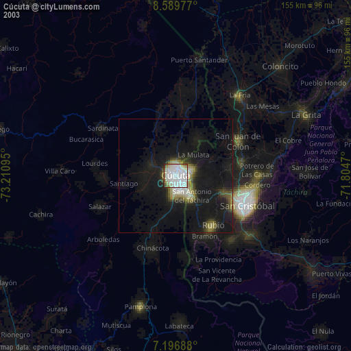
» NASA city lights 2003
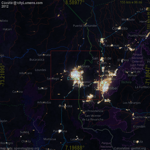
» Earth at Night: Flat Maps 2012, 2016