Barrancas night lights from space
Night Light of Barrancas (La Guajira) from space (Colombia) Src. Average luminocity for 10x10km area is 19.0779% and for 50x50km: 3.8999%.
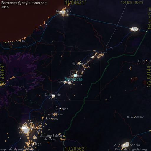
Analysis of Barrancas night lights 2016
Square area 10x10 km:
 4.76%
4.76%90-99
2.6%80-89
1.73%70-79
0%60-69
0.87%50-59
0.87%40-49
6.06%30-39
1.95%20-29
1.08%10-19
12.77%0-9
67.32%Square area 50x50 km:
0.62%90-99
0.45%80-89
0.32%70-79
0.26%60-69
0.31%50-59
0.41%40-49
0.65%30-39
1.19%20-29
0.54%10-19
1.54%0-9
93.7%Clear (daylight) street map image can be seen on geolist.org.
Map coordinates:
11° 38' 46.4" North, 73° 29' 51.7" West
10° 57' 24.2" North, 72° 47' 40.4" West
10° 15' 56.2" North, 72° 5' 29.2" West
Some cities around Barrancas sort by population:
• Riohacha
66.5 km =41.3 mi,  349°
349°
• San Juan del Cesar
30.7 km =19.1 mi,  227°
227°
• Fonseca
9.8 km =6.1 mi,  216°
216°
• Villanueva
43.7 km =27.2 mi,  207°
207°
• Urumita
50.2 km =31.2 mi, 208°
• Manaure Balcón del Cesar
67.9 km =42.2 mi,  202°
202°
• Albania
31.7 km =19.7 mi,  44°
44°
• El Molino
36.6 km =22.7 mi, 202°
3689162 (p: 17,350)
Sources (retrieved 2019-11-25):
» Earth at Night: Flat Maps 2012, 2016