Maicao night lights from space
Night Light of Maicao (La Guajira) from space (Colombia) Src. Average luminocity for 10x10km area is 29.7338% and for 50x50km: 1.5032%.
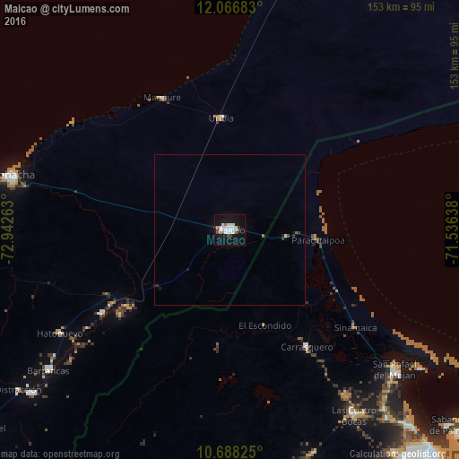
Analysis of Maicao night lights 2016
Square area 10x10 km:
 7.36%
7.36%90-99
10.39%80-89
1.3%70-79
0%60-69
2.16%50-59
1.3%40-49
0.87%30-39
4.76%20-29
0.87%10-19
33.33%0-9
37.66%Square area 50x50 km:
0.29%90-99
0.44%80-89
0.05%70-79
0%60-69
0.08%50-59
0.12%40-49
0.08%30-39
0.25%20-29
0.15%10-19
1.44%0-9
97.09%Clear (daylight) street map image can be seen on geolist.org.
Map coordinates:
12° 4' 0.6" North, 72° 56' 33.5" West
11° 22' 42.1" North, 72° 14' 22.2" West
10° 41' 17.7" North, 71° 32' 11" West
Some cities around Maicao sort by population:
• Maracaibo, VE
104.6 km =65 mi,  139°
139°
• Riohacha
75.1 km =46.7 mi,  284°
284°
• San Juan del Cesar
107.3 km =66.7 mi,  230°
230°
• Fonseca
86.1 km =53.5 mi, 230°
• Barrancas
76.6 km =47.6 mi, 232°
• Manaure
49.4 km =30.7 mi,  333°
333°
• Uribia
37.5 km =23.3 mi,  355°
355°
• Albania
45.4 km =28.2 mi,  237°
237°
3675657 (p: 130,348)
Sources (retrieved 2019-11-25):
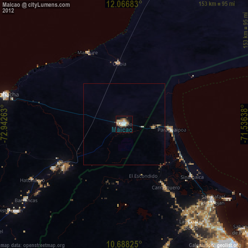
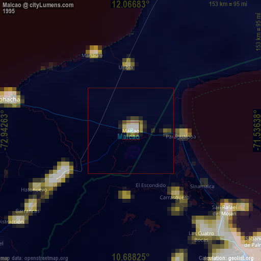
» NASA, Earths city lights 1995
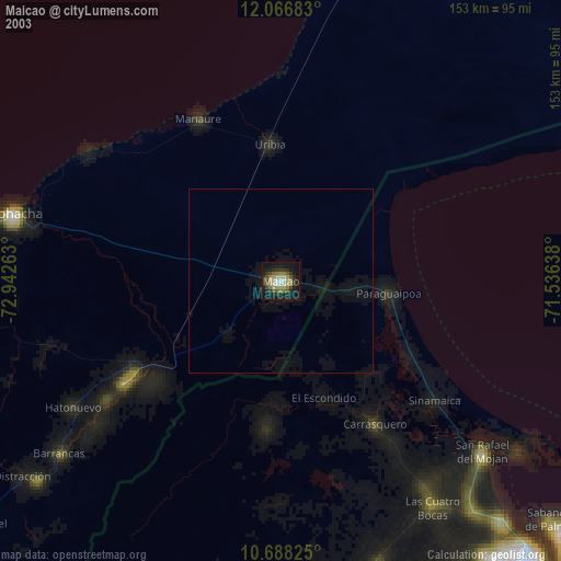
» NASA city lights 2003
» Earth at Night: Flat Maps 2012, 2016