Ciudad Guayana night lights from space
Night Light of Ciudad Guayana (Bolívar) from space (Venezuela) Src. Average luminocity for 10x10km area is 86.4112% and for 50x50km: 18.983%.
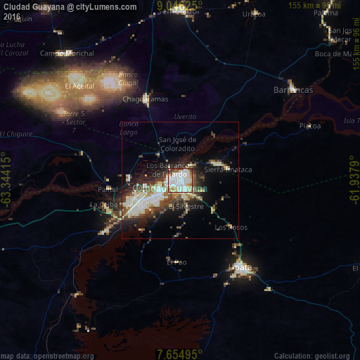
Analysis of Ciudad Guayana night lights 2016
Square area 10x10 km:
 35.12%
90-99
29.75%80-89
13.22%70-79
1.86%60-69
5.58%50-59
3.51%40-49
4.96%30-39
4.96%20-29
1.03%10-19
0%0-9
0%Square area 50x50 km:
3.48%90-99
4.57%80-89
3.08%70-79
0.87%60-69
1.38%50-59
2.38%40-49
2.95%30-39
3.38%20-29
4.76%10-19
7.66%0-9
65.49%Clear (daylight) street map image can be seen on geolist.org.
Map coordinates:
9° 2' 46.5" North, 63° 20' 38.9" West
8° 21' 4.4" North, 62° 38' 27.7" West
7° 39' 17.8" North, 61° 56' 16.4" West
Some cities around Ciudad Guayana sort by population:
• Maturín
166.1 km =103.2 mi,  338°
338°
• El Tigre
187 km =116.2 mi,  288°
288°
• Anaco
233.4 km =145 mi,  300°
300°
• San José de Guanipa
177.8 km =110.5 mi, 289°
• Upata
45.4 km =28.2 mi,  145°
145°
• Tucupita
102 km =63.4 mi,  39°
39°
• Cantaura
216.5 km =134.5 mi, 299°
• Point Fortin, TT
228.3 km =141.9 mi,  27°
27°
3645528 (p: 746,535)
Sources (retrieved 2019-11-25):
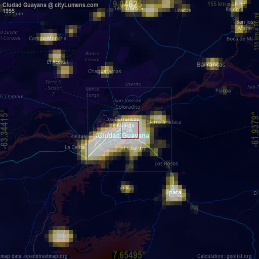
» NASA, Earths city lights 1995
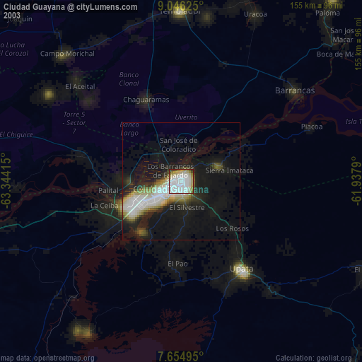
» NASA city lights 2003
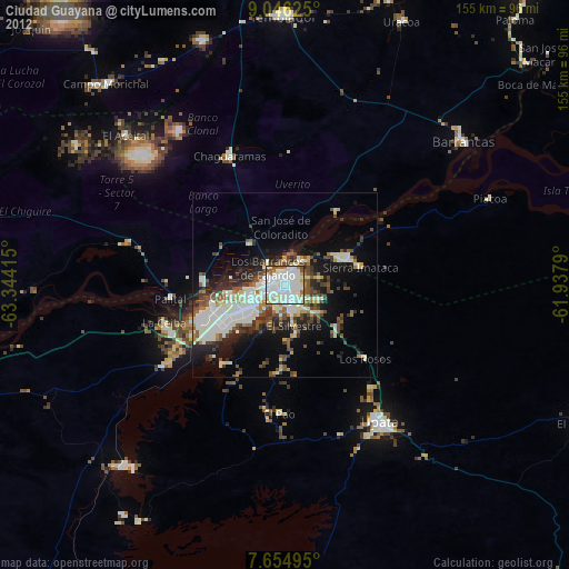
» Earth at Night: Flat Maps 2012, 2016