Maturín night lights from space
Night Light of Maturín (Monagas) from space (Venezuela) Src. Average luminocity for 10x10km area is 94.9026% and for 50x50km: 45.4248%.
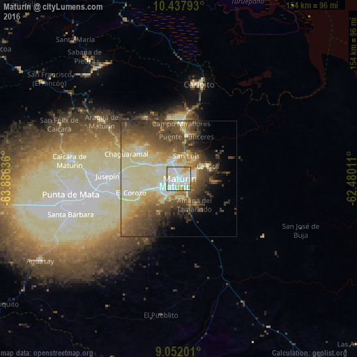
Analysis of Maturín night lights 2016
Square area 10x10 km:
 37.66%
90-99
44.16%80-89
9.09%70-79
7.36%60-69
1.73%50-59
0%40-49
0%30-39
0%20-29
0%10-19
0%0-9
0%Square area 50x50 km:
4.21%90-99
11.82%80-89
10.93%70-79
4.72%60-69
5.34%50-59
7.92%40-49
10.88%30-39
7.66%20-29
3.88%10-19
4.55%0-9
28.09%Clear (daylight) street map image can be seen on geolist.org.
Map coordinates:
10° 26' 16.5" North, 63° 53' 10.9" West
9° 44' 44.5" North, 63° 10' 59.6" West
9° 3' 7.2" North, 62° 28' 48.4" West
Some cities around Maturín sort by population:
• Cumaná
134.8 km =83.8 mi,  305°
305°
• El Tigre
151.1 km =93.9 mi,  230°
230°
• Anaco
144.8 km =90 mi,  255°
255°
• Carúpano
102.5 km =63.7 mi,  355°
355°
• San José de Guanipa
143.9 km =89.4 mi, 228°
• Tucupita
145.9 km =90.7 mi,  121°
121°
• Güiria
133.9 km =83.2 mi,  46°
46°
• Cantaura
137.8 km =85.6 mi,  249°
249°
3778045 (p: 410,972)
Sources (retrieved 2019-11-25):
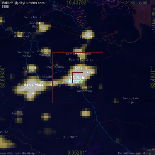
» NASA, Earths city lights 1995
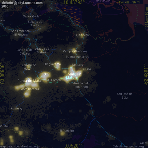
» NASA city lights 2003
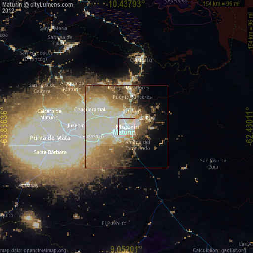
» Earth at Night: Flat Maps 2012, 2016