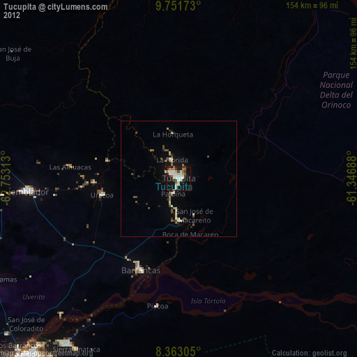
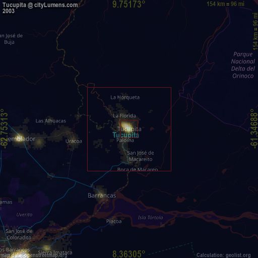
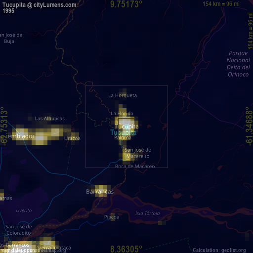
Tucupita night lights from space
Night Light of Tucupita (Delta Amacuro) from space (Venezuela) Src. Average luminocity for 10x10km area is 37.1429% and for 50x50km: 3.0061%.

Analysis of Tucupita night lights 2016
Square area 10x10 km:
 5.84%
5.84%90-99
10.39%80-89
6.28%70-79
1.3%60-69
0.87%50-59
2.6%40-49
6.06%30-39
6.28%20-29
6.28%10-19
41.56%0-9
12.55%Square area 50x50 km:
0.23%90-99
0.57%80-89
0.54%70-79
0.2%60-69
0.17%50-59
0.12%40-49
0.54%30-39
0.52%20-29
0.68%10-19
2.74%0-9
93.7%Clear (daylight) street map image can be seen on geolist.org.
Map coordinates:
9° 45' 6.2" North, 62° 45' 11.3" West
9° 3' 29" North, 62° 3' 0" West
8° 21' 47" North, 61° 20' 48.8" West
Some cities around Tucupita sort by population:
• Ciudad Guayana
102 km =63.4 mi,  219°
219°
• Maturín
145.9 km =90.7 mi,  301°
301°
• Mon Repos, TT
151.1 km =93.9 mi,  25°
25°
• San Fernando, TT
150 km =93.2 mi, 25°
• Upata
122.3 km =76 mi,  198°
198°
• Point Fortin, TT
130.4 km =81 mi,  17°
17°
• Peñal, TT
138.9 km =86.3 mi, 27°
• Siparia, TT
134.7 km =83.7 mi, 26°
3625929 (p: 51,534)
Sources (retrieved 2019-11-25):
» NASA, Earths city lights 1995
» NASA city lights 2003
» Earth at Night: Flat Maps 2012, 2016