Romiton night lights from space
Night Light of Romiton (Bukhara) from space (Uzbekistan) Src. Average luminocity for 10x10km area is 8.0221% and for 50x50km: 9.7742%.
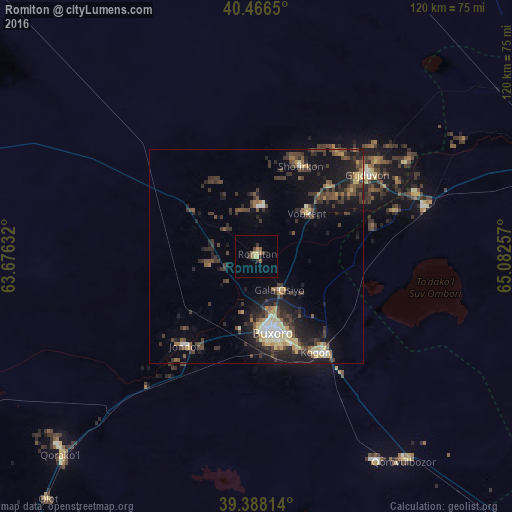
Analysis of Romiton night lights 2016
Square area 10x10 km:
 0%
0%90-99
0%80-89
2.55%70-79
0.17%60-69
1.53%50-59
2.55%40-49
0.68%30-39
1.19%20-29
2.21%10-19
1.36%0-9
87.76%Square area 50x50 km:
0.52%90-99
0.88%80-89
1.61%70-79
0.71%60-69
1.02%50-59
1.43%40-49
2.39%30-39
3.43%20-29
3.19%10-19
7.7%0-9
77.12%Clear (daylight) street map image can be seen on geolist.org.
Map coordinates:
40° 27' 59.4" North, 63° 40' 34.8" East
39° 55' 46" North, 64° 22' 46" East
39° 23' 17.3" North, 65° 4' 57.3" East
Some cities around Romiton sort by population:
• Bukhara
17.7 km =11 mi,  166°
166°
• Kogon
27.3 km =17 mi,  147°
147°
• Ghijduwon
32.1 km =19.9 mi,  53°
53°
• Shofirkon
23.6 km =14.7 mi,  26°
26°
• Wobkent
16.1 km =10 mi, 45°
• Galaosiyo
9.9 km =6.2 mi,  143°
143°
• Qiziltepa
41.7 km =25.9 mi,  73°
73°
• Qorovulbozor
59.4 km =36.9 mi, 143°
1216290 (p: 12,927)
Sources (retrieved 2019-11-25):
» Earth at Night: Flat Maps 2012, 2016