Ghijduwon night lights from space
Night Light of Ghijduwon (Bukhara) from space (Uzbekistan) Src. Average luminocity for 10x10km area is 42.461% and for 50x50km: 6.6641%.
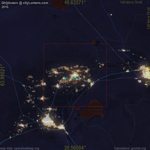
Analysis of Ghijduwon night lights 2016
Square area 10x10 km:
 1.3%
1.3%90-99
2.92%80-89
9.25%70-79
4.55%60-69
6.33%50-59
10.06%40-49
13.31%30-39
10.88%20-29
19.81%10-19
21.59%0-9
0%Square area 50x50 km:
0.11%90-99
0.29%80-89
0.71%70-79
0.5%60-69
0.89%50-59
1.25%40-49
1.86%30-39
2.67%20-29
2.4%10-19
6.35%0-9
82.97%Clear (daylight) street map image can be seen on geolist.org.
Map coordinates:
40° 38' 8.6" North, 63° 58' 48.8" East
40° 6' 0" North, 64° 40' 60" East
39° 33' 36.1" North, 65° 23' 11.3" East
Some cities around Ghijduwon sort by population:
• Bukhara
42.2 km =26.2 mi,  210°
210°
• Navoiy
59.2 km =36.8 mi,  91°
91°
• Kogon
43.4 km =27 mi,  194°
194°
• Shofirkon
15.6 km =9.7 mi,  278°
278°
• Wobkent
16.3 km =10.1 mi,  241°
241°
• Galaosiyo
33.6 km =20.9 mi,  216°
216°
• Qiziltepa
16 km =9.9 mi,  117°
117°
• Romiton
32.1 km =19.9 mi,  233°
233°
1513983 (p: 41,070)
Sources (retrieved 2019-11-25):
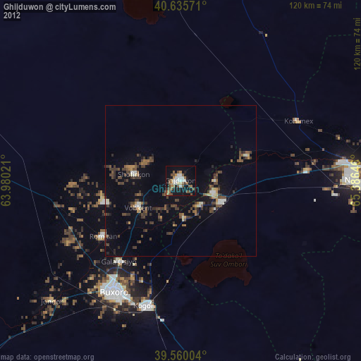
» Earth at Night: Flat Maps 2012, 2016