Qiziltepa night lights from space
Night Light of Qiziltepa (Navoiy) from space (Uzbekistan) Src. Average luminocity for 10x10km area is 15.3198% and for 50x50km: 5.1147%.
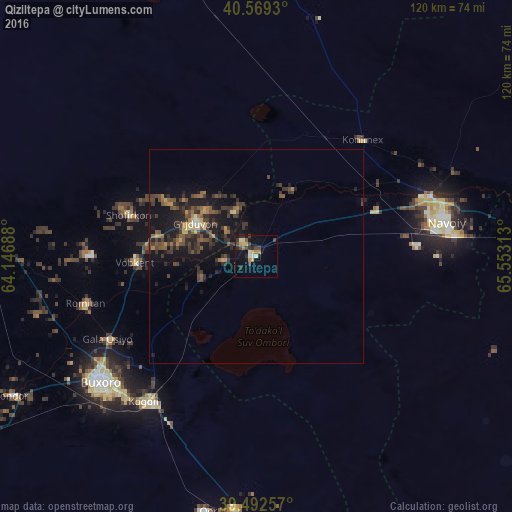
Analysis of Qiziltepa night lights 2016
Square area 10x10 km:
 0.32%
0.32%90-99
1.79%80-89
3.25%70-79
1.79%60-69
2.6%50-59
0.16%40-49
2.44%30-39
5.19%20-29
4.22%10-19
10.55%0-9
67.69%Square area 50x50 km:
0.07%90-99
0.19%80-89
0.61%70-79
0.41%60-69
0.73%50-59
0.95%40-49
1.49%30-39
2.03%20-29
1.88%10-19
5.58%0-9
86.09%Clear (daylight) street map image can be seen on geolist.org.
Map coordinates:
40° 34' 9.5" North, 64° 8' 48.8" East
40° 1' 59" North, 64° 51' 0" East
39° 29' 33.3" North, 65° 33' 11.3" East
Some cities around Qiziltepa sort by population:
• Bukhara
46 km =28.6 mi,  231°
231°
• Navoiy
45.4 km =28.2 mi,  82°
82°
• Kogon
42.9 km =26.7 mi,  216°
216°
• Ghijduwon
16 km =9.9 mi,  297°
297°
• Shofirkon
31.2 km =19.4 mi,  288°
288°
• Wobkent
28.5 km =17.7 mi,  269°
269°
• Galaosiyo
39.4 km =24.5 mi,  240°
240°
• Romiton
41.7 km =25.9 mi,  253°
253°
1513288 (p: 13,558)
Sources (retrieved 2019-11-25):
» Earth at Night: Flat Maps 2012, 2016