Olmaliq night lights from space
Night Light of Olmaliq (Toshkent) from space (Uzbekistan) Src. Average luminocity for 10x10km area is 43.5833% and for 50x50km: 6.1038%.
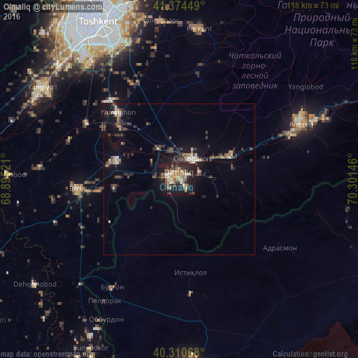
Analysis of Olmaliq night lights 2016
Square area 10x10 km:
 3.4%
3.4%90-99
6.29%80-89
5.78%70-79
5.95%60-69
11.73%50-59
8.33%40-49
3.23%30-39
8.84%20-29
17.69%10-19
26.02%0-9
2.72%Square area 50x50 km:
0.41%90-99
0.7%80-89
0.47%70-79
0.58%60-69
0.91%50-59
0.86%40-49
1.05%30-39
1.88%20-29
2.05%10-19
4.92%0-9
86.17%Clear (daylight) street map image can be seen on geolist.org.
Map coordinates:
41° 22' 28.2" North, 68° 53' 42.8" East
40° 50' 41" North, 69° 35' 54" East
40° 18' 38.4" North, 70° 18' 5.3" East
Some cities around Olmaliq sort by population:
• Ohangaron
7.6 km =4.7 mi,  26°
26°
• Piskent
21.6 km =13.4 mi,  285°
285°
• Tŭytepa
28.7 km =17.8 mi,  316°
316°
• Bo‘ka
34.2 km =21.3 mi,  263°
263°
• Adrasmon, TJ
39.1 km =24.3 mi,  123°
123°
• Bŭston, TJ
42.2 km =26.2 mi,  212°
212°
• Taboshar, TJ
30.7 km =19.1 mi,  173°
173°
• Konsoy, TJ
40.2 km =25 mi, 167°
1513064 (p: 121,207)
Sources (retrieved 2019-11-25):
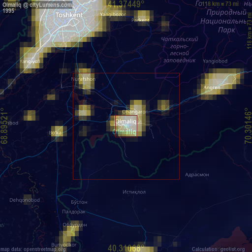
» NASA, Earths city lights 1995
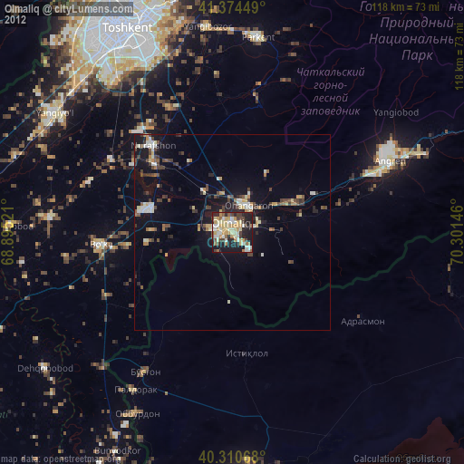
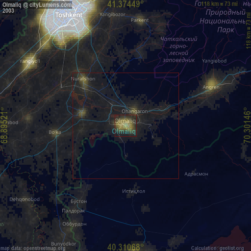
» NASA city lights 2003
» Earth at Night: Flat Maps 2012, 2016