Bŭston night lights from space
Night Light of Bŭston (Sughd) from space (Tajikistan) Src. Average luminocity for 10x10km area is 2.6922% and for 50x50km: 2.5704%.
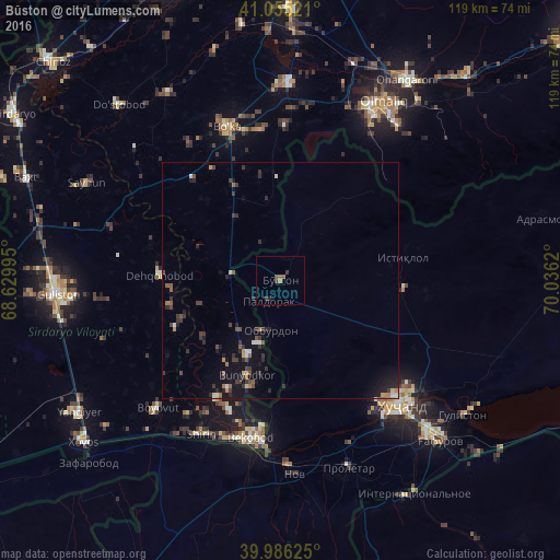
Analysis of Bŭston night lights 2016
Square area 10x10 km:
 0%
0%90-99
0%80-89
0%70-79
0.68%60-69
0.17%50-59
1.19%40-49
1.02%30-39
1.7%20-29
0.68%10-19
0%0-9
94.56%Square area 50x50 km:
0.11%90-99
0.23%80-89
0.17%70-79
0.24%60-69
0.32%50-59
0.39%40-49
0.48%30-39
0.94%20-29
0.89%10-19
2.07%0-9
94.15%Clear (daylight) street map image can be seen on geolist.org.
Map coordinates:
41° 3' 18.8" North, 68° 37' 47.8" East
40° 31' 22.3" North, 69° 19' 59.1" East
39° 59' 10.5" North, 70° 2' 10.3" East
Some cities around Bŭston sort by population:
• Khŭjand
36.2 km =22.5 mi,  137°
137°
• Bekobod, UZ
34 km =21.1 mi,  189°
189°
• Piskent, UZ
41.7 km =25.9 mi,  2°
2°
• Bo‘ka, UZ
34.1 km =21.2 mi,  339°
339°
• Proletar
42.1 km =26.2 mi,  160°
160°
• Nov
41.3 km =25.7 mi,  175°
175°
• Taboshar
26.6 km =16.5 mi,  78°
78°
• Konsoy
31.4 km =19.5 mi,  96°
96°
1514913 (p: 13,043)
Sources (retrieved 2019-11-25):
» Earth at Night: Flat Maps 2012, 2016