Konsoy night lights from space
Night Light of Konsoy (Sughd) from space (Tajikistan) Src. Average luminocity for 10x10km area is 0.4439% and for 50x50km: 2.0821%.
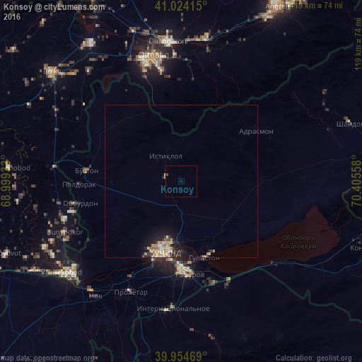
Analysis of Konsoy night lights 2016
Square area 10x10 km:
 0%
0%90-99
0%80-89
0%70-79
0%60-69
0%50-59
0%40-49
0.68%30-39
0%20-29
0%10-19
0%0-9
99.32%Square area 50x50 km:
0.16%90-99
0.34%80-89
0.36%70-79
0.47%60-69
0.27%50-59
0.17%40-49
0.06%30-39
0.43%20-29
0.57%10-19
1.48%0-9
95.71%Clear (daylight) street map image can be seen on geolist.org.
Map coordinates:
41° 1' 26.9" North, 68° 59' 57.6" East
40° 29' 29.6" North, 69° 42' 8.8" East
39° 57' 16.9" North, 70° 24' 20.1" East
Some cities around Konsoy sort by population:
• Khŭjand
24.2 km =15 mi,  196°
196°
• Olmaliq, UZ
40.2 km =25 mi,  347°
347°
• Ohangaron, UZ
46.4 km =28.8 mi, 353°
• Chkalov
28.6 km =17.8 mi,  181°
181°
• Proletar
39.9 km =24.8 mi,  205°
205°
• Adrasmon
29.6 km =18.4 mi,  53°
53°
• Bŭston
31.4 km =19.5 mi,  276°
276°
• Taboshar
10.1 km =6.3 mi,  329°
329°
1514889 (p: 5,042)
Sources (retrieved 2019-11-25):
» Earth at Night: Flat Maps 2012, 2016