Dashtobod night lights from space
Night Light of Dashtobod (Jizzax) from space (Uzbekistan) Src. Average luminocity for 10x10km area is 8.0357% and for 50x50km: 1.0807%.
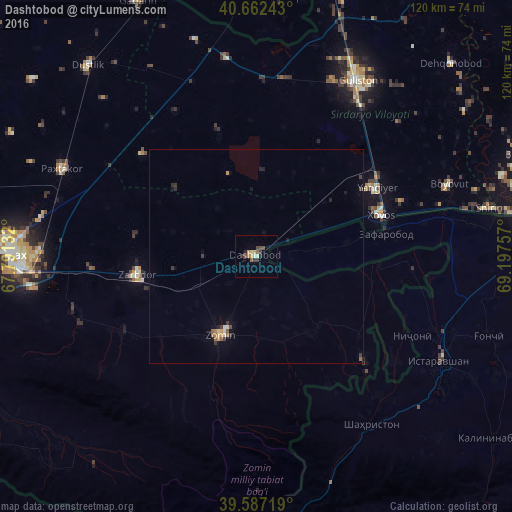
Analysis of Dashtobod night lights 2016
Square area 10x10 km:
 0.32%
0.32%90-99
0.81%80-89
0.49%70-79
2.27%60-69
0.65%50-59
1.79%40-49
2.11%30-39
2.11%20-29
1.46%10-19
0.32%0-9
87.66%Square area 50x50 km:
0.05%90-99
0.1%80-89
0.09%70-79
0.18%60-69
0.12%50-59
0.23%40-49
0.1%30-39
0.37%20-29
0.23%10-19
0.18%0-9
98.36%Clear (daylight) street map image can be seen on geolist.org.
Map coordinates:
40° 39' 44.7" North, 67° 47' 28.8" East
40° 7' 37" North, 68° 29' 40" East
39° 35' 13.9" North, 69° 11' 51.3" East
Some cities around Dashtobod sort by population:
• Jizzax
55.5 km =34.5 mi,  268°
268°
• Guliston
47.2 km =29.3 mi,  31°
31°
• Istaravshan, TJ
49.4 km =30.7 mi,  118°
118°
• Yangiyer
32.4 km =20.1 mi,  59°
59°
• Zomin
20.3 km =12.6 mi,  204°
204°
• Paxtakor
50.4 km =31.3 mi,  294°
294°
• Dŭstlik
58.9 km =36.6 mi,  318°
318°
• Pakhtakoron, TJ
21.7 km =13.5 mi,  81°
81°
1512480 (p: 19,718)
Sources (retrieved 2019-11-25):
» Earth at Night: Flat Maps 2012, 2016