Pakhtakoron night lights from space
Night Light of Pakhtakoron (Sughd) from space (Tajikistan) Src. Average luminocity for 10x10km area is 0.1006% and for 50x50km: 1.658%.
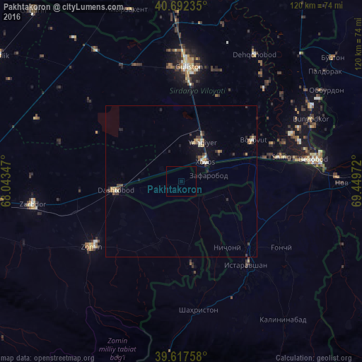
Analysis of Pakhtakoron night lights 2016
Square area 10x10 km:
 0%
0%90-99
0%80-89
0%70-79
0%60-69
0%50-59
0%40-49
0%30-39
0%20-29
0%10-19
0%0-9
100%Square area 50x50 km:
0.05%90-99
0.28%80-89
0.15%70-79
0.22%60-69
0.19%50-59
0.2%40-49
0.33%30-39
0.51%20-29
0.25%10-19
0.74%0-9
97.09%Clear (daylight) street map image can be seen on geolist.org.
Map coordinates:
40° 41' 32.5" North, 68° 2' 36.5" East
40° 9' 25.5" North, 68° 44' 47.7" East
39° 37' 3.3" North, 69° 26' 59" East
Some cities around Pakhtakoron sort by population:
• Bekobod, UZ
45 km =28 mi,  80°
80°
• Guliston, UZ
37.1 km =23.1 mi,  4°
4°
• Istaravshan
34.7 km =21.6 mi,  141°
141°
• Yangiyer, UZ
14.6 km =9.1 mi,  26°
26°
• Zomin, UZ
37 km =23 mi,  233°
233°
• Dashtobod, UZ
21.7 km =13.5 mi,  261°
261°
• Nov
53 km =32.9 mi,  90°
90°
• Myrzakent, KZ
58.8 km =36.5 mi,  343°
343°
1514844 (p: 8,220)
Sources (retrieved 2019-11-25):
» Earth at Night: Flat Maps 2012, 2016