Paxtakor night lights from space
Night Light of Paxtakor (Jizzax) from space (Uzbekistan) Src. Average luminocity for 10x10km area is 7.9167% and for 50x50km: 5.0658%.
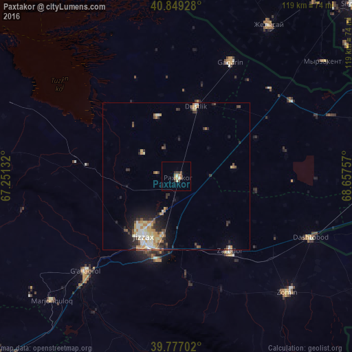
Analysis of Paxtakor night lights 2016
Square area 10x10 km:
 0.34%
0.34%90-99
1.7%80-89
0.51%70-79
0.51%60-69
2.38%50-59
1.19%40-49
1.19%30-39
2.38%20-29
0%10-19
0%0-9
89.8%Square area 50x50 km:
0.39%90-99
1.14%80-89
0.66%70-79
0.87%60-69
0.7%50-59
0.39%40-49
0.72%30-39
0.78%20-29
1.38%10-19
2.27%0-9
90.69%Clear (daylight) street map image can be seen on geolist.org.
Map coordinates:
40° 50' 57.4" North, 67° 15' 4.8" East
40° 18' 55" North, 67° 57' 16" East
39° 46' 37.3" North, 68° 39' 27.3" East
Some cities around Paxtakor sort by population:
• Jizzax
24.1 km =15 mi,  203°
203°
• Guliston
72.9 km =45.3 mi,  74°
74°
• Zomin
54.4 km =33.8 mi,  136°
136°
• Gagarin
42.7 km =26.5 mi,  25°
25°
• Dashtobod
50.4 km =31.3 mi,  114°
114°
• Dŭstlik
24.3 km =15.1 mi,  16°
16°
• Myrzakent, KZ
63.2 km =39.3 mi,  52°
52°
• Pakhtakoron, TJ
69.5 km =43.2 mi,  104°
104°
1513038 (p: 21,384)
Sources (retrieved 2019-11-25):
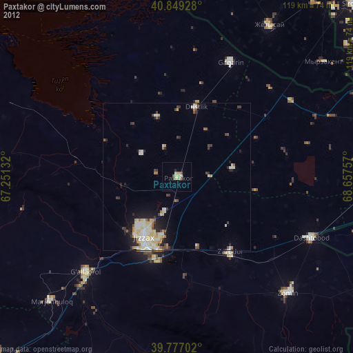
» Earth at Night: Flat Maps 2012, 2016