Bella Unión night lights from space
Night Light of Bella Unión (Artigas) from space (Uruguay) Src. Average luminocity for 10x10km area is 25.0892% and for 50x50km: 1.9993%.
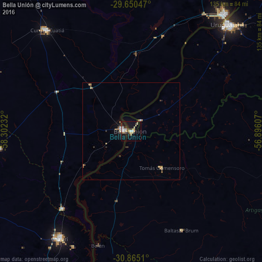
Analysis of Bella Unión night lights 2016
Square area 10x10 km:
 4.55%
4.55%90-99
3.5%80-89
4.72%70-79
1.92%60-69
2.1%50-59
2.97%40-49
2.1%30-39
4.02%20-29
1.22%10-19
30.07%0-9
42.83%Square area 50x50 km:
0.24%90-99
0.19%80-89
0.36%70-79
0.21%60-69
0.32%50-59
0.21%40-49
0.23%30-39
0.37%20-29
0.13%10-19
1.58%0-9
96.16%Clear (daylight) street map image can be seen on geolist.org.
Map coordinates:
29° 39' 1.7" South, 58° 18' 8.4" West
30° 15' 34.8" South, 57° 35' 57.1" West
30° 51' 54.4" South, 56° 53' 45.9" West
Some cities around Bella Unión sort by population:
• Uruguaiana, BR
74.6 km =46.4 mi,  41°
41°
• Paso de los Libres, AR
78.3 km =48.7 mi, 38°
• Artigas
109.8 km =68.2 mi,  98°
98°
• Curuzú Cuatiá, AR
68 km =42.3 mi,  319°
319°
• Chajarí, AR
65.6 km =40.8 mi,  213°
213°
• Monte Caseros, AR
3.6 km =2.2 mi,  280°
280°
• Federación, AR
87.8 km =54.6 mi,  199°
199°
• Mocoretá, AR
53.1 km =33 mi,  221°
221°
3443631 (p: 13,171)
Sources (retrieved 2019-11-25):
» Earth at Night: Flat Maps 2012, 2016