Yulee night lights from space
Night Light of Yulee (Florida) from space (United States) Src. Average luminocity for 10x10km area is 27.3374% and for 50x50km: 19.5029%.
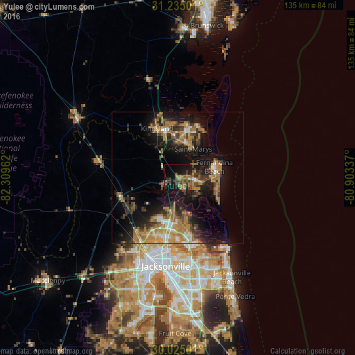
Analysis of Yulee night lights 2016
Square area 10x10 km:
 0.35%
0.35%90-99
0.17%80-89
0.52%70-79
4.72%60-69
12.94%50-59
5.42%40-49
6.12%30-39
7.34%20-29
4.2%10-19
27.1%0-9
31.12%Square area 50x50 km:
1.55%90-99
1.78%80-89
1.16%70-79
4.88%60-69
5.86%50-59
1.91%40-49
2.55%30-39
4%20-29
4.78%10-19
14.79%0-9
56.75%Clear (daylight) street map image can be seen on geolist.org.
Map coordinates:
31° 14' 6" North, 82° 18' 34.6" West
30° 37' 54.8" North, 81° 36' 23.4" West
30° 1' 30" North, 80° 54' 12.1" West
Some cities around Yulee sort by population:
• Jacksonville
33.7 km =20.9 mi,  188°
188°
• Jacksonville Beach
42.7 km =26.5 mi,  151°
151°
• St. Marys
12.4 km =7.7 mi,  27°
27°
• Kingsland
20.3 km =12.6 mi,  336°
336°
• Atlantic Beach
38.6 km =24 mi, 148°
• Fernandina Beach
14.4 km =8.9 mi,  73°
73°
• Neptune Beach
40.9 km =25.4 mi, 150°
• Nassau Village-Ratliff
23.6 km =14.7 mi,  235°
235°
4178919 (p: 11,491)
Sources (retrieved 2019-11-25):
» Earth at Night: Flat Maps 2012, 2016