Neptune Beach night lights from space
Night Light of Neptune Beach (Florida) from space (United States) Src. Average luminocity for 10x10km area is 52.5641% and for 50x50km: 33.1202%.
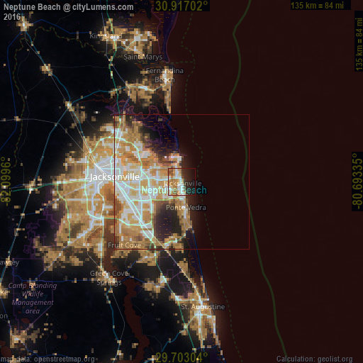
Analysis of Neptune Beach night lights 2016
Square area 10x10 km:
 10.44%
90-99
11.36%80-89
3.66%70-79
13.92%60-69
9.16%50-59
5.68%40-49
4.21%30-39
1.28%20-29
14.65%10-19
16.3%0-9
9.34%Square area 50x50 km:
7.08%90-99
7.02%80-89
4.19%70-79
7.28%60-69
7.22%50-59
2.39%40-49
2.97%30-39
2.13%20-29
4.75%10-19
5.87%0-9
49.09%Clear (daylight) street map image can be seen on geolist.org.
Map coordinates:
30° 55' 1.3" North, 82° 5' 58.6" West
30° 18' 42.9" North, 81° 23' 47.3" West
29° 42' 10.9" North, 80° 41' 36.1" West
Some cities around Neptune Beach sort by population:
• Jacksonville
25 km =15.5 mi,  275°
275°
• St. Johns
29.5 km =18.3 mi,  209°
209°
• Ponte Vedra Beach
8.1 km =5 mi,  172°
172°
• Fruit Cove
32.5 km =20.2 mi,  226°
226°
• Jacksonville Beach
1.9 km =1.2 mi, 170°
• Palm Valley
15 km =9.3 mi,  176°
176°
• Atlantic Beach
2.5 km =1.6 mi,  355°
355°
• Orange Park
33.9 km =21.1 mi,  241°
241°
4165695 (p: 7,269)
Sources (retrieved 2019-11-25):
» Earth at Night: Flat Maps 2012, 2016