Jacksonville night lights from space
Night Light of Jacksonville (Florida) from space (United States) Src. Average luminocity for 10x10km area is 94.5952% and for 50x50km: 54.432%.
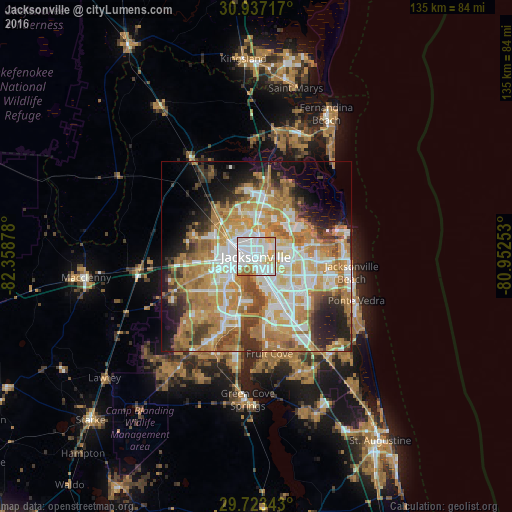
Analysis of Jacksonville night lights 2016
Square area 10x10 km:
 47.07%
90-99
31.87%80-89
9.52%70-79
6.59%60-69
4.95%50-59
0%40-49
0%30-39
0%20-29
0%10-19
0%0-9
0%Square area 50x50 km:
11.27%90-99
10.9%80-89
5.99%70-79
13.38%60-69
12.15%50-59
4.55%40-49
5.43%30-39
4.71%20-29
6.45%10-19
9.01%0-9
16.18%Clear (daylight) street map image can be seen on geolist.org.
Map coordinates:
30° 56' 13.8" North, 82° 21' 31.6" West
30° 19' 55.8" North, 81° 39' 20.3" West
29° 43' 24.3" North, 80° 57' 9.1" West
Fantastic image of Jacksonville from space taken by astronauts [src2], but I don't have information about it's orientation, scale or angle. If necessary, it was rotated manually, so North points approximately to upper direction. Click to zoom in:

Some cities around Jacksonville sort by population:
• Lakeside
24.9 km =15.5 mi,  205°
205°
• Fruit Cove
24.6 km =15.3 mi,  176°
176°
• Oakleaf Plantation
24.9 km =15.5 mi,  223°
223°
• Bellair-Meadowbrook Terrace
19 km =11.8 mi, 206°
• Atlantic Beach
24.7 km =15.3 mi,  89°
89°
• Orange Park
19.1 km =11.9 mi,  194°
194°
• Neptune Beach
25 km =15.5 mi,  95°
95°
• Nassau Village-Ratliff
24.8 km =15.4 mi,  323°
323°
4160021 (p: 868,031)
Sources (retrieved 2019-11-25):
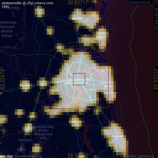
» NASA, Earths city lights 1995
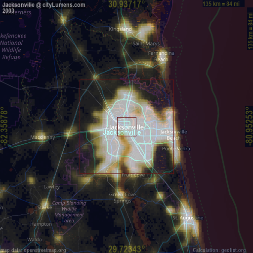
» NASA city lights 2003
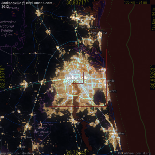
» Earth at Night: Flat Maps 2012, 2016
Src.2: Shane Kimbrough, @astro_kimbrough 2017