Yucaipa night lights from space
Night Light of Yucaipa (California) from space (United States) Src. Average luminocity for 10x10km area is 42.771% and for 50x50km: 27.3108%.
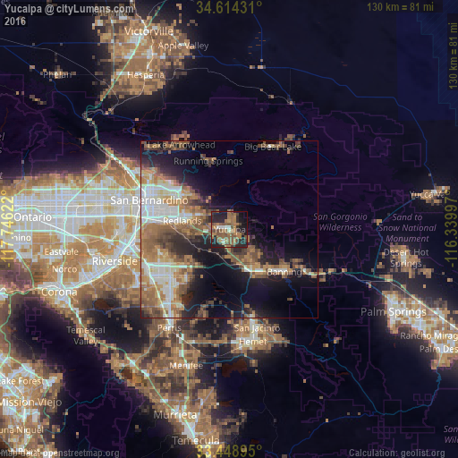
Analysis of Yucaipa night lights 2016
Square area 10x10 km:
 1.92%
1.92%90-99
3.15%80-89
1.22%70-79
2.8%60-69
18.88%50-59
14.51%40-49
11.89%30-39
5.24%20-29
19.76%10-19
16.26%0-9
4.37%Square area 50x50 km:
4.25%90-99
4.31%80-89
2.13%70-79
3.13%60-69
7.04%50-59
5.47%40-49
4.87%30-39
3.33%20-29
5.74%10-19
11.17%0-9
48.56%Clear (daylight) street map image can be seen on geolist.org.
Map coordinates:
34° 36' 51.5" North, 117° 44' 46.4" West
34° 2' 1.1" North, 117° 2' 35.1" West
33° 26' 56.2" North, 116° 20' 23.9" West
Some cities around Yucaipa sort by population:
• Redlands
13.1 km =8.1 mi,  280°
280°
• Highland
18.5 km =11.5 mi,  304°
304°
• Beaumont
13.1 km =8.1 mi,  152°
152°
• Banning
19.5 km =12.1 mi,  128°
128°
• Loma Linda
20.2 km =12.6 mi,  274°
274°
• Mentone
9.3 km =5.8 mi, 295°
• Calimesa
3.7 km =2.3 mi,  207°
207°
• Cherry Valley
9.1 km =5.7 mi,  138°
138°
5411046 (p: 53,328)
Sources (retrieved 2019-11-25):
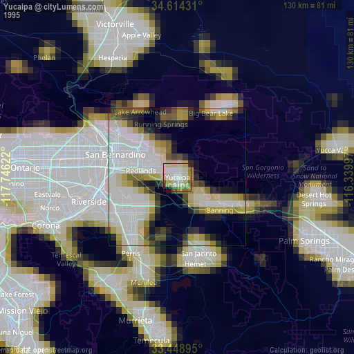
» NASA, Earths city lights 1995
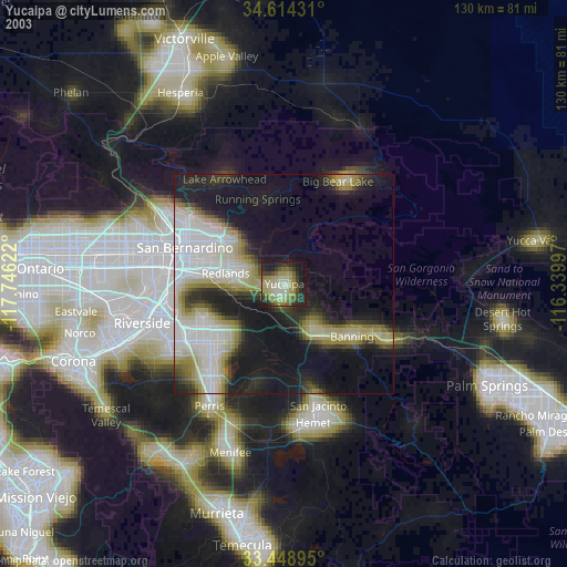
» NASA city lights 2003
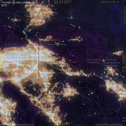
» Earth at Night: Flat Maps 2012, 2016