Mentone night lights from space
Night Light of Mentone (California) from space (United States) Src. Average luminocity for 10x10km area is 53.5245% and for 50x50km: 36.0803%.
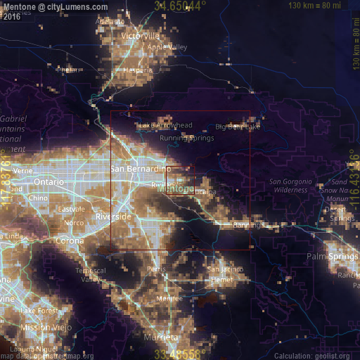
Analysis of Mentone night lights 2016
Square area 10x10 km:
 4.2%
4.2%90-99
5.42%80-89
1.75%70-79
6.64%60-69
24.13%50-59
18.88%40-49
10.14%30-39
10.31%20-29
10.84%10-19
6.12%0-9
1.57%Square area 50x50 km:
6.77%90-99
6.8%80-89
3.67%70-79
5.09%60-69
8.97%50-59
6%40-49
4.86%30-39
2.93%20-29
5.4%10-19
9.99%0-9
39.52%Clear (daylight) street map image can be seen on geolist.org.
Map coordinates:
34° 39' 1.6" North, 117° 50' 15.4" West
34° 4' 12" North, 117° 8' 4.1" West
33° 29' 8.1" North, 116° 25' 52.9" West
Some cities around Mentone sort by population:
• San Bernardino
14.9 km =9.3 mi,  286°
286°
• Redlands
4.7 km =2.9 mi,  250°
250°
• Highland
9.4 km =5.8 mi,  313°
313°
• Colton
16.5 km =10.3 mi,  271°
271°
• Yucaipa
9.3 km =5.8 mi,  115°
115°
• Loma Linda
11.9 km =7.4 mi,  258°
258°
• Grand Terrace
17 km =10.6 mi, 256°
• Calimesa
9.9 km =6.2 mi,  137°
137°
5372242 (p: 8,720)
Sources (retrieved 2019-11-25):
» Earth at Night: Flat Maps 2012, 2016