Redlands night lights from space
Night Light of Redlands (California) from space (United States) Src. Average luminocity for 10x10km area is 68.5122% and for 50x50km: 41.9933%.
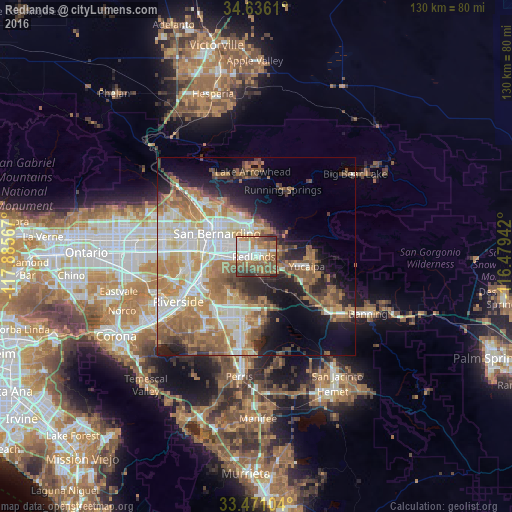
Analysis of Redlands night lights 2016
Square area 10x10 km:
 15.21%
90-99
13.46%80-89
0.87%70-79
9.97%60-69
22.73%50-59
16.08%40-49
11.54%30-39
7.52%20-29
2.62%10-19
0%0-9
0%Square area 50x50 km:
7.83%90-99
8.31%80-89
4.61%70-79
6.31%60-69
10.47%50-59
6.71%40-49
5.09%30-39
3.35%20-29
6%10-19
10.17%0-9
31.15%Clear (daylight) street map image can be seen on geolist.org.
Map coordinates:
34° 38' 10" North, 117° 53' 8.4" West
34° 3' 20.1" North, 117° 10' 57.1" West
33° 28' 15.7" North, 116° 28' 45.9" West
Some cities around Redlands sort by population:
• San Bernardino
11.5 km =7.1 mi,  300°
300°
• Highland
8.4 km =5.2 mi,  343°
343°
• Colton
12.2 km =7.6 mi,  279°
279°
• Yucaipa
13.1 km =8.1 mi,  100°
100°
• Loma Linda
7.3 km =4.5 mi,  263°
263°
• Grand Terrace
12.3 km =7.6 mi, 258°
• Mentone
4.7 km =2.9 mi,  70°
70°
• Calimesa
12.5 km =7.8 mi,  117°
117°
5386754 (p: 71,035)
Sources (retrieved 2019-11-25):
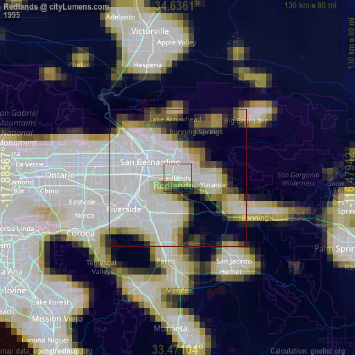
» NASA, Earths city lights 1995
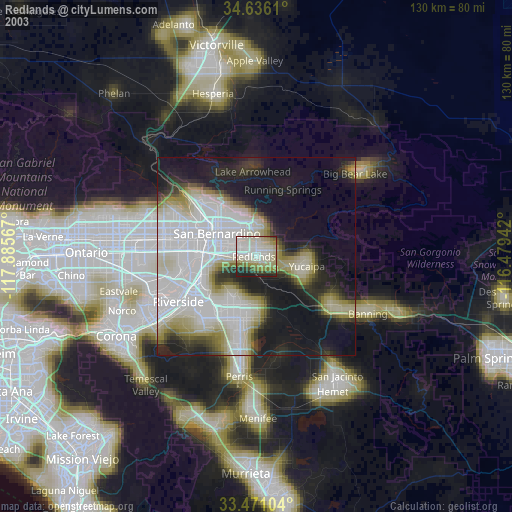
» NASA city lights 2003
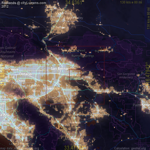
» Earth at Night: Flat Maps 2012, 2016