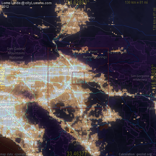
Loma Linda night lights from space
Night Light of Loma Linda (California) from space (United States) Src. Average luminocity for 10x10km area is 77.5% and for 50x50km: 49.5075%.
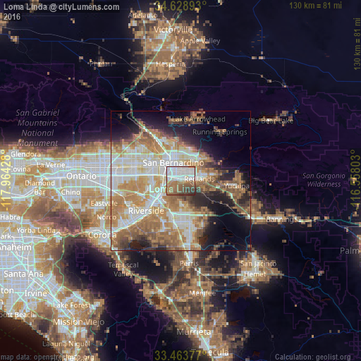
Analysis of Loma Linda night lights 2016
Square area 10x10 km:
 31.47%
90-99
16.78%80-89
2.1%70-79
5.24%60-69
18.53%50-59
11.19%40-49
9.09%30-39
4.02%20-29
1.57%10-19
0%0-9
0%Square area 50x50 km:
9.91%90-99
10.45%80-89
5.67%70-79
7.5%60-69
12.61%50-59
7.17%40-49
5.01%30-39
3.69%20-29
6.34%10-19
9.43%0-9
22.22%Clear (daylight) street map image can be seen on geolist.org.
Map coordinates:
34° 37' 44.1" North, 117° 57' 51.4" West
34° 2' 54.1" North, 117° 15' 40.1" West
33° 27' 49.6" North, 116° 33' 28.9" West
Some cities around Loma Linda sort by population:
• San Bernardino
7.2 km =4.5 mi,  338°
338°
• Moreno Valley
12.6 km =7.8 mi,  167°
167°
• Rialto
11.9 km =7.4 mi,  302°
302°
• Redlands
7.3 km =4.5 mi,  83°
83°
• Highland
10.1 km =6.3 mi,  28°
28°
• Colton
5.6 km =3.5 mi, 300°
• Grand Terrace
5.1 km =3.2 mi,  251°
251°
• Mentone
11.9 km =7.4 mi, 78°
5367696 (p: 24,045)
Sources (retrieved 2019-11-25):
» Earth at Night: Flat Maps 2012, 2016