Woodmere night lights from space
Night Light of Woodmere (New York) from space (United States) Src. Average luminocity for 10x10km area is 90.612% and for 50x50km: 54.8264%.
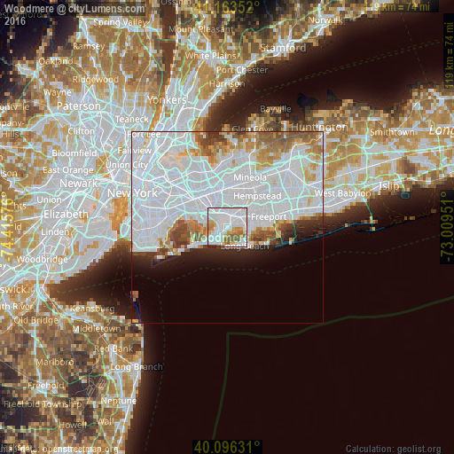
Analysis of Woodmere night lights 2016
Square area 10x10 km:
 53.08%
90-99
18.99%80-89
6.82%70-79
6.98%60-69
4.71%50-59
7.79%40-49
0.65%30-39
0.97%20-29
0%10-19
0%0-9
0%Square area 50x50 km:
31.42%90-99
11.55%80-89
3.21%70-79
3.14%60-69
3.61%50-59
2.91%40-49
2.06%30-39
1.98%20-29
2.83%10-19
4.15%0-9
33.14%Clear (daylight) street map image can be seen on geolist.org.
Map coordinates:
41° 9' 48.7" North, 74° 24' 56.7" West
40° 37' 55.4" North, 73° 42' 45.5" West
40° 5' 46.7" North, 73° 0' 34.2" West
Some cities around Woodmere sort by population:
• Valley Stream
3.6 km =2.2 mi,  5°
5°
• Rosedale
3.8 km =2.4 mi,  330°
330°
• East Rockaway
3.8 km =2.4 mi,  72°
72°
• Inwood
3.1 km =1.9 mi,  248°
248°
• Hewlett
1.9 km =1.2 mi,  49°
49°
• Cedarhurst
1.4 km =0.9 mi,  224°
224°
• Lawrence
2.3 km =1.4 mi, 218°
• South Valley Stream
2.7 km =1.7 mi,  350°
350°
5145028 (p: 17,121)
Sources (retrieved 2019-11-25):
» Earth at Night: Flat Maps 2012, 2016