Rosedale night lights from space
Night Light of Rosedale (New York) from space (United States) Src. Average luminocity for 10x10km area is 95.8295% and for 50x50km: 59.6263%.
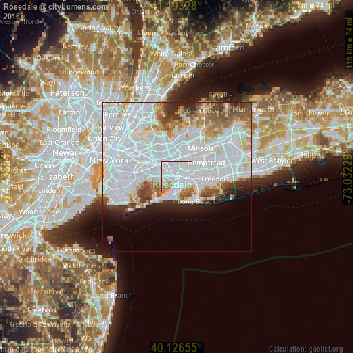
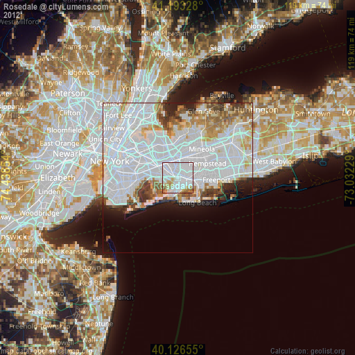
Analysis of Rosedale night lights 2016
Square area 10x10 km:
 68.34%
90-99
17.05%80-89
4.38%70-79
5.68%60-69
3.57%50-59
0.97%40-49
0%30-39
0%20-29
0%10-19
0%0-9
0%Square area 50x50 km:
33.46%90-99
12.55%80-89
3.55%70-79
3.5%60-69
3.9%50-59
3.48%40-49
2.85%30-39
2.5%20-29
3.71%10-19
4.17%0-9
26.34%Clear (daylight) street map image can be seen on geolist.org.
Map coordinates:
41° 11' 35.8" North, 74° 26' 18.7" West
40° 39' 43.4" North, 73° 44' 7.5" West
40° 7' 35.6" North, 73° 1' 56.2" West
Some cities around Rosedale sort by population:
• Valley Stream
2.3 km =1.4 mi,  83°
83°
• Springfield Gardens
2.3 km =1.4 mi,  273°
273°
• Laurelton
1.3 km =0.8 mi,  313°
313°
• Cambria Heights
3.6 km =2.2 mi,  355°
355°
• Woodmere
3.8 km =2.4 mi,  150°
150°
• North Valley Stream
3.8 km =2.4 mi,  47°
47°
• Hewlett
4 km =2.5 mi,  122°
122°
• South Valley Stream
1.6 km =1 mi,  114°
114°
5134395 (p: 25,812)
Sources (retrieved 2019-11-25):
» Earth at Night: Flat Maps 2012, 2016