Cedarhurst night lights from space
Night Light of Cedarhurst (New York) from space (United States) Src. Average luminocity for 10x10km area is 85.2321% and for 50x50km: 54.0471%.
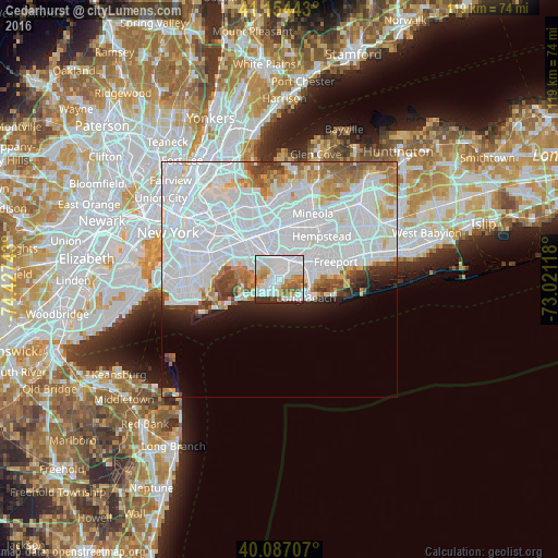
Analysis of Cedarhurst night lights 2016
Square area 10x10 km:
 42.21%
90-99
21.1%80-89
7.31%70-79
8.12%60-69
4.87%50-59
7.95%40-49
1.3%30-39
2.76%20-29
4.38%10-19
0%0-9
0%Square area 50x50 km:
31.34%90-99
11.51%80-89
3.05%70-79
2.93%60-69
3.36%50-59
2.55%40-49
2.03%30-39
1.84%20-29
2.78%10-19
4.34%0-9
34.25%Clear (daylight) street map image can be seen on geolist.org.
Map coordinates:
41° 9' 15.9" North, 74° 25' 38.7" West
40° 37' 22.4" North, 73° 43' 27.5" West
40° 5' 13.5" North, 73° 1' 16.2" West
Some cities around Cedarhurst sort by population:
• Far Rockaway
3.2 km =2 mi,  233°
233°
• Rosedale
4.5 km =2.8 mi,  347°
347°
• Woodmere
1.4 km =0.9 mi,  44°
44°
• Inwood
1.9 km =1.2 mi,  267°
267°
• Edgemere
4.7 km =2.9 mi, 230°
• Hewlett
3.3 km =2.1 mi,  46°
46°
• Lawrence
0.9 km =0.6 mi,  209°
209°
• South Valley Stream
3.7 km =2.3 mi,  8°
8°
5111974 (p: 6,682)
Sources (retrieved 2019-11-25):
» Earth at Night: Flat Maps 2012, 2016