Wood River night lights from space
Night Light of Wood River (Illinois) from space (United States) Src. Average luminocity for 10x10km area is 73.915% and for 50x50km: 38.7691%.
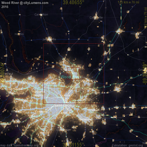
Analysis of Wood River night lights 2016
Square area 10x10 km:
 18.54%
90-99
20.58%80-89
8.33%70-79
7.14%60-69
16.67%50-59
10.2%40-49
7.48%30-39
3.4%20-29
7.65%10-19
0%0-9
0%Square area 50x50 km:
9.09%90-99
8.22%80-89
5.33%70-79
4.94%60-69
6.26%50-59
5.98%40-49
3.97%30-39
3.68%20-29
6.01%10-19
7.03%0-9
39.5%Clear (daylight) street map image can be seen on geolist.org.
Map coordinates:
39° 24' 23.6" North, 90° 48' 2.7" West
38° 51' 40.2" North, 90° 5' 51.4" West
38° 18' 41.6" North, 89° 23' 40.2" West
Some cities around Wood River sort by population:
• Upper Alton
7.2 km =4.5 mi,  320°
320°
• Alton
8.2 km =5.1 mi,  293°
293°
• Edwardsville
13.7 km =8.5 mi,  113°
113°
• Spanish Lake
13.1 km =8.1 mi,  231°
231°
• Godfrey
13 km =8.1 mi, 323°
• Bethalto
7.3 km =4.5 mi,  42°
42°
• East Alton
2.4 km =1.5 mi,  331°
331°
• Pontoon Beach
14.5 km =9 mi,  174°
174°
4253387 (p: 10,294)
Sources (retrieved 2019-11-25):
» Earth at Night: Flat Maps 2012, 2016