Wixom night lights from space
Night Light of Wixom (Michigan) from space (United States) Src. Average luminocity for 10x10km area is 60.1937% and for 50x50km: 47.2516%.
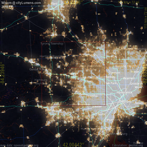
Analysis of Wixom night lights 2016
Square area 10x10 km:
 10.32%
90-99
10.48%80-89
4.76%70-79
8.41%60-69
12.86%50-59
16.19%40-49
14.29%30-39
7.78%20-29
12.06%10-19
2.86%0-9
0%Square area 50x50 km:
8.81%90-99
11.11%80-89
5.1%70-79
6.26%60-69
8.57%50-59
8.05%40-49
6.54%30-39
4.63%20-29
6.55%10-19
14.06%0-9
20.33%Clear (daylight) street map image can be seen on geolist.org.
Map coordinates:
43° 2' 26.9" North, 84° 14' 22.1" West
42° 31' 29.1" North, 83° 32' 10.8" West
42° 0' 15.9" North, 82° 49' 59.6" West
Some cities around Wixom sort by population:
• Farmington Hills
13.8 km =8.6 mi,  108°
108°
• West Bloomfield Township
13.4 km =8.3 mi,  68°
68°
• Novi
7 km =4.3 mi,  134°
134°
• South Lyon
11.8 km =7.3 mi,  232°
232°
• Farmington
14.7 km =9.1 mi,  117°
117°
• Walled Lake
4.8 km =3 mi, 72°
• Milford
9.2 km =5.7 mi,  326°
326°
• Northville
11.3 km =7 mi,  157°
157°
5015351 (p: 13,746)
Sources (retrieved 2019-11-25):
» Earth at Night: Flat Maps 2012, 2016