West Bloomfield Township night lights from space
Night Light of West Bloomfield Township (Michigan) from space (United States) Src. Average luminocity for 10x10km area is 61.8635% and for 50x50km: 58.5168%.
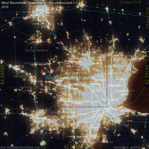

Analysis of West Bloomfield Township night lights 2016
Square area 10x10 km:
 5.56%
5.56%90-99
4.6%80-89
5.71%70-79
8.1%60-69
18.57%50-59
36.83%40-49
16.98%30-39
3.65%20-29
0%10-19
0%0-9
0%Square area 50x50 km:
16.97%90-99
12.39%80-89
5.74%70-79
7.41%60-69
10.81%50-59
8.58%40-49
6.08%30-39
4.83%20-29
5.61%10-19
9.3%0-9
12.27%Clear (daylight) street map image can be seen on geolist.org.
Map coordinates:
43° 5' 4.5" North, 84° 5' 12.1" West
42° 34' 8.1" North, 83° 23' 0.8" West
42° 2' 56.2" North, 82° 40' 49.6" West
Some cities around West Bloomfield Township sort by population:
• Farmington Hills
9.3 km =5.8 mi,  176°
176°
• Waterford
14 km =8.7 mi,  350°
350°
• Pontiac
10.9 km =6.8 mi,  44°
44°
• Novi
12.4 km =7.7 mi,  217°
217°
• Wixom
13.4 km =8.3 mi,  248°
248°
• Farmington
11.6 km =7.2 mi, 177°
• Beverly Hills
14.1 km =8.8 mi,  110°
110°
• Walled Lake
8.7 km =5.4 mi, 246°
7259621 (p: 64,690)
Sources (retrieved 2019-11-25):
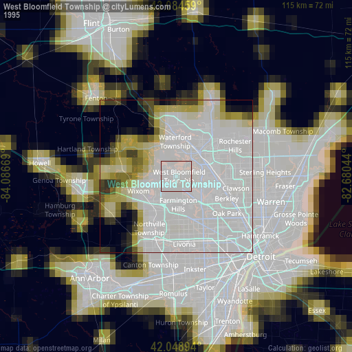
» NASA, Earths city lights 1995
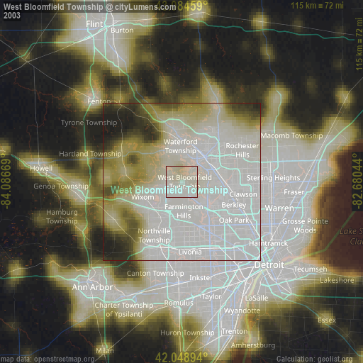
» NASA city lights 2003
» Earth at Night: Flat Maps 2012, 2016