Farmington night lights from space
Night Light of Farmington (Michigan) from space (United States) Src. Average luminocity for 10x10km area is 83.6937% and for 50x50km: 70.662%.
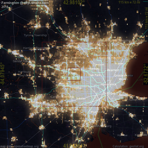
Analysis of Farmington night lights 2016
Square area 10x10 km:
 19.84%
90-99
26.35%80-89
9.05%70-79
20.48%60-69
23.65%50-59
0.63%40-49
0%30-39
0%20-29
0%10-19
0%0-9
0%Square area 50x50 km:
24.18%90-99
18.06%80-89
7.09%70-79
8.17%60-69
10.95%50-59
7.88%40-49
4.72%30-39
3.27%20-29
4.53%10-19
7.05%0-9
4.1%Clear (daylight) street map image can be seen on geolist.org.
Map coordinates:
42° 58' 51.7" North, 84° 4' 46" West
42° 27' 52.1" North, 83° 22' 34.8" West
41° 56' 37.1" North, 82° 40' 23.5" West
Some cities around Farmington sort by population:
• Livonia
10.9 km =6.8 mi,  169°
169°
• Southfield
12.7 km =7.9 mi,  85°
85°
• West Bloomfield Township
11.6 km =7.2 mi,  357°
357°
• Novi
8.3 km =5.2 mi,  282°
282°
• Redford
11.1 km =6.9 mi,  144°
144°
• Plymouth
12.9 km =8 mi,  216°
216°
• Walled Lake
11.8 km =7.3 mi,  313°
313°
• Northville
9.5 km =5.9 mi,  247°
247°
4992519 (p: 10,523)
Sources (retrieved 2019-11-25):
» Earth at Night: Flat Maps 2012, 2016